
• 0 items in quote

    No products in the Quote Basket.

  • 100% Free. No Credit Card Required.

    Sign Up
    Get started.

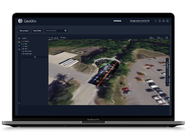
    Transform your post-field workflow with Geolitix – the intuitive, web-based platform built to streamline data processing, visualization, and interpretation.

    We invite you to try Geolitix for free for three months – compliments of GSSI and Geolitix. This free trial includes a max project and storage size of 10GB!

    Use this unique link to sign up:

    GSSI Free Geolitix Trial

    Link expires 9/29/26

    Guided Video Walk-Through

    Watch the videos below to see just how easy it is to use Geolitix. Then download our data sets to practice yourself!

    Quick Start Guide

    Take a tour of the Geolitix user interface and get ready for your first project!

    Utility Mapping

    Download our Utility Data Set from Dropbox, then follow along as we show you how to use GPS-enabled GPR data to analyze a utility locate with Geolitix.

    Concrete Grid

    Download our Concrete Data Set from Dropbox, then walk through assembling a 2″x2″ concrete grid collected with the NX25 and using Geolitix for post-processing.

    Get A Preview

    To view examples of finished project results from Geolitix, click these public links. No sign-up required.

    UTILITY MAP

    CONCRETE GRID

    Additional Data Examples
    Import GPR Data Into Geolitix

    This data set was collected with the UtilityScan system and Emild Reach GNSS receiver with NTRIP corrections to get the most accurate location for the utility mark out.

    A ‘random walk’ looping pattern was done to collect the data outside of GSSI. This method drastically cuts down the data collection time compared to collecting data using a traditional grid method. 

    3D GPR Interpretation in Geolitix for Utilities

    In this image, utilities were interpreted in 3D space and classified based on in-field context clues. Data was brought into Geolitix where it was sliced using the easy “Suggest parameters” tool.  In Geolitix software, interpretations can be exported in various formats, or a Public Link can be created to share the interactive 3D project directly with clients.

    This entire process, from field collection to a shareable 3D model, demonstrates a highly efficient workflow for modern utility locating and damage prevention using GSSI GPR and Geolitix.

    Better Understanding of Concrete GPR Data in Geolitix

    A large concrete grid, with 269 individual profiles totaling 4GB, was collected with Flex NX and assembled in Geolitix.

    The data revealed highly detailed information about previous saw cuts and wire mesh layout, and helped to visualize an area of thicker concrete with rebar or conduit running along the bottom of an area of dipping mesh. Below the slab were multiple PVC pipes and a rodent burrow.

    The Multislice feature in Geolitix provided a full top-to-bottom view of the GPR slices by assigning different colors to targets at various depths. The resulting image provided a powerful mission-planning tool for any subsequent cutting, coring, or drilling projects.

    3D Fence Diagram for Geological Data

    This data was collected to investigate the stratigraphic relationship between late Pleistocene dunes and deltas in Merrimack, New Hampshire.

    200 HS GPR profiles were collected with a RTK GPS, then imported into Geolitix where they were displayed in a 3D fence diagram with a satellite image for context. Digitization of major GPR reflectors was instrumental in fully visualizing and interpreting the stratigraphic sequence.

    LEARN MORE

    For Geolitix Plans and Pricing
    Click Here!

    Contact our Sales Team

    Please provide the following information and we will contact you shortly.
    If you prefer, call 603-864-0847. If you need to contact Training, click here.


    Click here to allow our Sales and Marketing team to email you about GSSI products and services.

    This form collects the information that you provide to us. Check our Privacy Policy for the full story on how we protect and manage your submitted data.