Geology & Geophysics

Geology & Geophysics

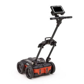
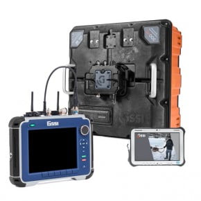
Ground penetrating radar (GPR) offers an accurate, non-destructive solution to mapping the subsurface of the earth. With GSSI GPR antennas, it is simple to locate features of interest and subsurface layers in real time, up to 100 feet or more.
Geology
  • Water Table Mapping
  • Bedrock Profiling
  • Bathymetry
  • Sinkhole Areas
  • Stratigraphy
Agriculture & Forestry
  • Golf Course Maintenance
  • Tree Assessment
  • Drainage Tiles
Mining
  • Mine Safety
  • Mineral Exploration
  • Salt Mining
Ice and Snow
  • Ice Road Thickness
  • Glaciology Studies
  • Crevasse Detection

Geology

GSSI Solution - Geology - Data Example 1

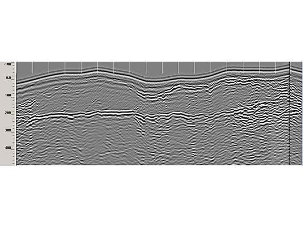
Geology: Water Table Mapping

Hydrogeologists use ground penetrating radar to determine the depth to water table and to predict potential pathways for subsurface flow.

This data illustrates a well defined water table. Elevation data has been corrected using topography data in RADAN 7. Data was collected with the SIR 4000 and 200 MHz antenna.

GSSI Solution - Geology - Data Example 2

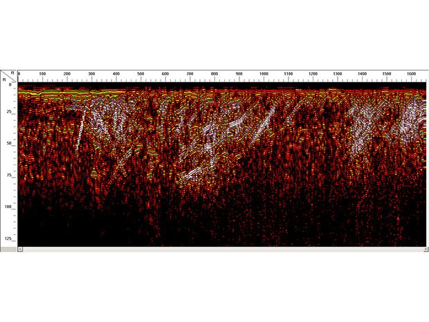
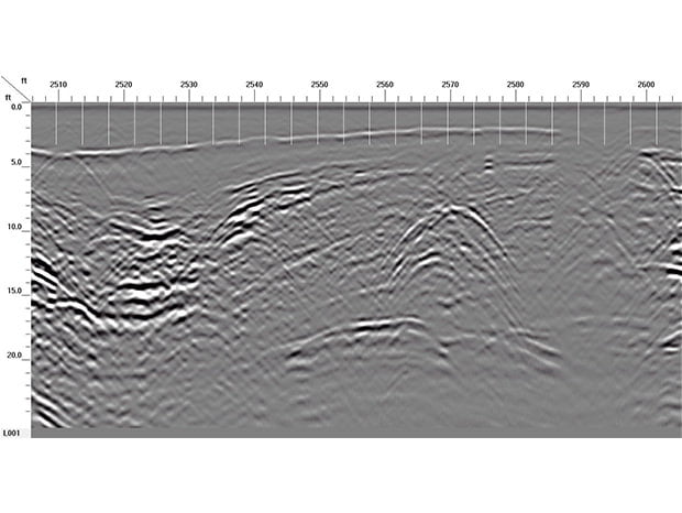
Geology: Collect and Profile Bedrock

Geologists and land developers use bedrock depth information for construction planning purposes and identifying pathways for subsurface water flow. GSSI ground penetrating radar systems provide a rapid, cost-effective method for collecting large amounts of bedrock depth information.

This data image is a low frequency GPR data set that was collected with a SIR 4000 and 400 MHz antenna. The data shows steeply dipping bedrock fractures within metamorphic bedrock.

GSSI Solution - Geology - Data Example 3

Geology: Measure Bathymetry

Bathymetric profiling is used by geologists for investigating soft, sub-bottom sediments and underwater targets in freshwater rivers and lakes. Ground penetrating radar can aid in locating sub-bottom stratigraphy as well as underwater targets, including natural and foreign objects.

2D data set collected with GPS positioning down a river in Vermont. This data was collected by floating a 200 MHz antenna in a raft alongside a power boat. A SIR 4000 with external GPS and 200 MHZ were used to collect this data. Data is shown in RADAN 7.

GSSI Solution - Geology - Data Example 4

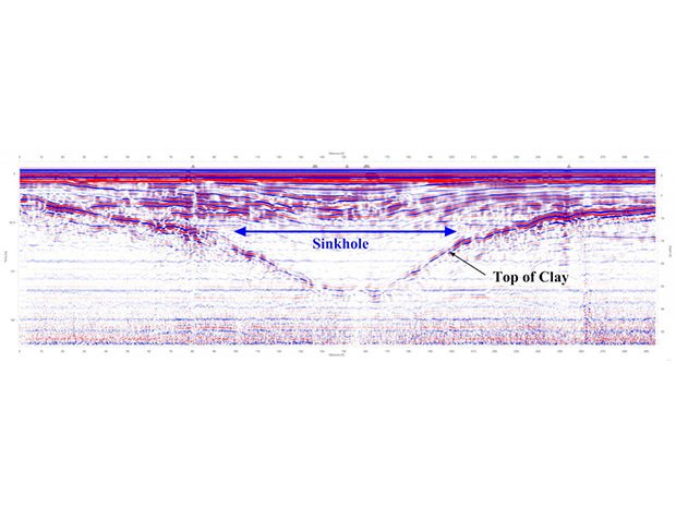
Geology: Locate Potential Sinkhole Areas

Geologists can locate and measure the depth of sinkholes, and features related to karst environments, in real-time with GSSI’s ground penetrating radar systems.

This 2D data file was taken in Florida over a slumping surface feature over an existing sink hole.

GSSI Solution - Geology - Data Example 5

Geology: Map Stratigraphy

Geologists employ GPR to examine complex subsurface problems, such as stratigraphy. Detailed information such as thin layers and cross bedding can be easily resolved.

This data set shows stratigraphic layers created by backfilling at a construction site. In the center of the data is a large septic tank. This data was collected with a SIR 4000 and 200 MHz antenna.

Agriculture and Forestry

GSSI Solution - Agriculture - Data Example 1

Agriculture and Forestry: Golf Course Maintenance

Ground penetrating radar is an invaluable tool for golf course superintendents who want to non-destructively locate drainage and irrigation pipes and delineate areas of excess water saturation on the greens.

This is a Google Earth™ image, with GSSI GPR data overlay, of the Manchester Country Club’s 12th fairway, in Bedford, NH. The image shows the original Donald Ross designed fairway, the data identifies a bunker that was removed in the late 1930’s and two water lines underneath the fairway.

GSSI Solution - Agriculture - Data Example 2

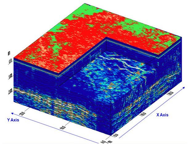
Agriculture and Forestry: Map Tree Roots and Analyze Tree Health

Ground penetrating radar aids arborists in collecting high-resolution data images of tree root systems. Additionally, GPR is used to measure tree trunk characteristics in order to identify potential insect and fungal infestation that can affect the tree’s health.

This 3D data set is of a root structure beneath an oak tree. The large horizontal reflector on 2D fence data shows a shallow water table. This data was collected with a 400 MHz antenna.

GSSI Solution - Agriculture - Data Example 3

Agriculture and Forestry: Locate Drainage Tiles

Locating farm drainage networks is a difficult and time-consuming task. The traditional solution was to dig or probe to find the position of drainage pipes. Ground penetrating radar provides a faster and more accurate survey method to locate and map drainage pipes.

This data set is from a farm field in Ohio showing farm drainage tiles. The bottom hyperbolas are clay tiles and the top hyperbolas are PVC replacement. This data was collected with a 200 MHz antenna.

Mining

GSSI Solution - Environmental - Mining - Data Example 1

Mining: Determine Mine Safety

Mining professionals use ground penetrating radar to accurately locate underground structures before drilling, blasting or carrying face operations. GPR is instrumental in helping to identify overhead separations in order to prevent ceiling collapses. In deep mine applications, GPR is invaluable for identifying geologic features that may be potential areas for rock bursts, such as fractures, shear zones and faults.

This data illustrates a GPR scan of the roof in a salt mine and shows the variable thickness of salt in the roof structure. This data was collected with a SIR 30E and a 400 MHz antenna.

GSSI Solution - Environmental - Mining - Data Example 2

Mining: Mineral Exploration

Mining professionals use ground penetrating radar for mineral exploration in igneous and metamorphic rocks, such as granitic pegmatite, to locate hydrothermal features including cavities and vugs.

This 2D data set shows a large void containing emeralds in a pegmatite mine. This data was collected with a 900 MHz in contact with the rock surface.

GSSI Solution - Environmental - Mining - Data Example 3

Mining: Maximize Salt Yield

Ground penetrating radar is used in salt mining applications to maximize yield. GSSI GPR allows miners to navigate continuous mining machines by way of imagining the salt/shale interface. In addition, GPR can be used to maintain proper roof structure to create a safe mining environment, while at the same time maximizing the yield.

This data illustrates a floor GPR scan in a salt seam mine located in Ohio. Data shows a clear and well-defined salt shale boundary. This data was collected with a SIR 30E and 400 MHz antenna. Data is being utilized for determining proper amount of salt for creating a safe structural roof.

Ice and Snow

GSSI Solution - Environmental - Ice and Snow - Data Example 1

Ice and Snow: Characterize Ice Road Thickness

Ice road construction companies use GSSI ground penetrating radar to gather ice thickness information and determine whether travel over icy passages is safe. The Canadian diamond mining industry relies on GPR to determine if manufactured frozen ice roads are secure.

This 2D data set was collected with a SIR 4000 and 400 MHz antenna over an ice road. The red circled area shows debris located just below ice layer.

GSSI Solution - Environmental - Ice and Snow - Data Example 2

Ice and Snow: Glaciology Studies

Research scientists use ground penetrating radar to study the internal structure of glaciers. The properties of ice allow for large penetration depths while producing strikingly high-resolution data sets of glacial ice.

This data image shows snow/ice layering as well as open and filled crevasses. This was collected with the SIR 4000 and a 400 MHz antenna near McMurdo Station, Ross Island, Antarctica.

GSSI Solution - Environmental - Ice and Snow - Data Example 3

Ice and Snow: Crevasse Detection

Scientific teams and civil engineers use ground penetrating radar to ensure the safe passage of vehicles and people over glacial ice. Glacial features, such as shear zones, create hazards that can be detected and avoided by using GPR.

This 2D data set was collected in Time Mode using a SIR 4000 and 400 MHz antenna. Data shows flat line snow stratigraphy interrupted by a series of high angle reflectors caused by a crevasse snow air boundary. This data was collected in Antarctica.