Jamestown Uses GPR to Define Lost 17th Century Landscape
GSSI archaeologists Dan Welch and Peter Leach have been traveling to Jamestown, Virginia – the first permanent English settlement in the New World – to help the Jamestown Rediscovery Foundation commemorate the 400th-anniversary of the first representative government and arrival of the first Africans, both of which took place in 1619.

Last spring, Dan and Peter joined senior archaeologist Dave Givens to help define the landscape of the first Africans. The Angela site, named after one of the first Angolans to arrive in 1619, consists of seven acres of garden, domestic quarters and storehouses all belonging to Angela’s owner, wealthy Jamestonian Captain William Pierce.
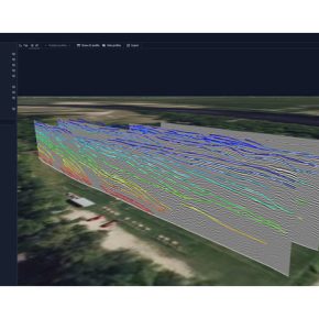
Archaeologists from GSSI, the National Parks Service, and Jamestown Rediscovery conducted a GPR survey in part of the town, which not only clearly defined numerous buildings, boundary ditches, and post holes, but also added critical information on how the town was laid out.
Building on the success of the work on the first Africans, Dan and Peter returned to Jamestown this summer to help solve a new problem: the site of the first General Assembly in the New World. This site is located inside the Memorial Church, a brick structure built in 1906 over the original timber-framed structure constructed in 1617. It was in this church that the democratic experiment of representative government first met in 1619. The goal of the archaeologists is to define the 1617 church and the location where the assembly met.
At the Church dig site GSSI and Jamestown Rediscovery team collaborated to answer some critical questions about the site of the country’s first representative government. The team wanted to know which (tile) floors were constructed first without digging away the delicate fabric of the structure, so they could meet the goal of preserving as much as possible for the future. To meet the goal, Dan and Peter used a GPR system used more often for remote sensing of rebar, post-tension cables and conduits rather than archaeology. The team thought this high-frequency system, the StructureScan Mini XT with the Palm XT antenna, could give them the higher resolution of local areas in the church that would help them define activity spaces.
An important part of the survey included burials located in “high status” areas, including one that records suggested might be the remains of Sir George Yeardley, planter and three-time colonial Governor of the British Colony of Virginia, who was also among the first slave holders in what would eventually become the United States. The StructureScan Mini XT and Palm XT were used to create high-resolution imagery of the skeletal remains prior to excavation. The FBI and University of Leicester (UK) Professor Turi King will conduct a DNA test on the teeth and skeletal remains, while Jamestown Rediscovery will continue its research and archaeological dig.
For a fascinating discussion on the church dig, check out this interesting story in Smithsonian Magazine, A Jamestown Skeleton is Unearthed, but Only Time—and Science—Will Reveal His True Identity or this article by the BBC News Service, Sir George Yeardley: The Briton who shaped early America.


