
200 HS Antenna


200 HS Antenna
Rugged, Wireless Low Frequency 200 MHz GPR System
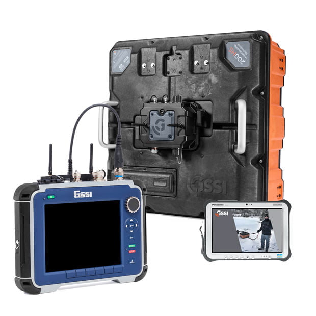
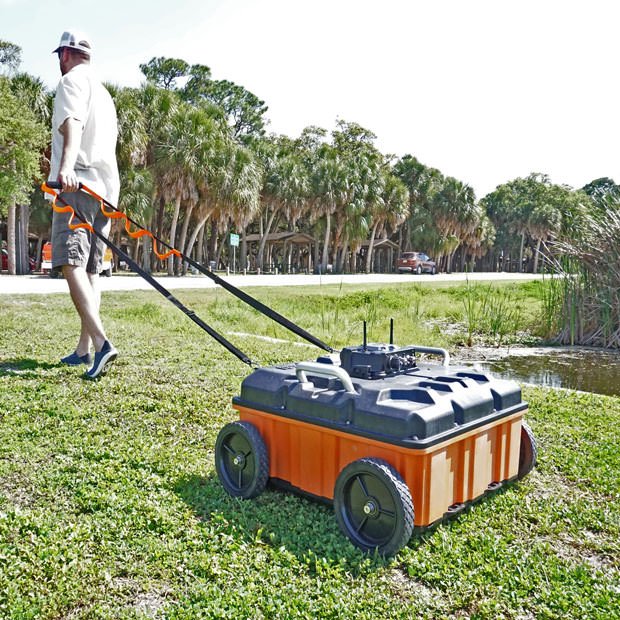
GSSI introduces the GS Series, our next-generation family of high-performance antennas targeting applications that require deeper penetration depths. The first antenna in the series is the 200 HS. This digital, wireless antenna features a 200 MHz center frequency and employs GSSI’s proprietary HyperStacking® technology. This technology improves signal to noise performance and increases depth penetration under all soil conditions. The GS Series is ideal for geophysical, geotechnical, and environmental applications that require high reliability under challenging survey conditions.
-
Max Depth
21 m (70 ft)
-
Antenna Frequency
200 MHz
-
Weight
17.9kg (39.6 lbs)
-
Storage Capacity
SIR 4000: 32 GB
Panasonic Toughpad G2: 512 GB -
Optional Software
RADAN 7
-
Accessories
Wheel kit, GPS mount, Transit case, Survey wheel
- Water Table Mapping
- Bedrock Profiling
- Bathymetry
- Sinkhole Areas
- Stratigraphy
- Deeper Utility Detection
- Archaeological Investigations
- Controller: SIR® 4000 (with WiFi Module) or
Panasonic® Toughpad G2 - 200 HS Antenna with HS Module
- Tow Handle
- Lithium-ion battery (4)
- Dual-bay battery charger

-

Acquire Data Wirelessly
Identify geophysical characteristics easily with the wireless 200 HS and HS Module. The HS Module connects the SIR 4000 or Panasonic Toughpad G2 to the antenna and allows the user to leverage a single HS Module across all GS Series antennas.
-

HyperStacking Technology & Improved Depth
The GS Series uses our patented HyperStacking Technology to provide clearer data, from superficial features to deeper characteristics. Our 200 HS antenna achieves greater depth penetration, nearly double than conventional GPR antenna designs.
-

System Versatility
The GS Series caters to new and existing users with two controller choices; SIR 4000 with a WiFi module, or Panasonic Toughpad tablet. IP 65 rated, the 200 HS antenna can withstand dust and is water resistant.
-

Advanced Features
The GS Series incorporates advanced features designed for survey efficiency including an integrated GPS, and can accommodate an external GPS mount. Visualize data on the tablet with a GIS map mode. Use accessories to customize survey collection modes.


| 200 HS Antenna | |
| Center Frequency | 200 MHz |
| Max Depth | 21 m (70 ft)* |
| Battery Life | 4 hours |
| Environmental Rating | IP65 |
| Vibration | Mil-STD-810G Method 514.6C Category 9 |
| Operating Temperature | -10°C to 40°C external (14°F to 104°F) |
| Weight | 17.9kg (39.6 lbs) |
| Dimensions | 64.8 x 64.8 x 34.3 cm (25.5 x 25.5 x 13.5 in) |
| Model | 50200HS |
| Data Acquisition | |
| Data Format | RADAN® (dzt) |
| Output Data Format | 32-bit |
| Scan Interval | Up to 200 scans/sec |
| Number Of Samples Per Scan | 512, 1024, 2048, 4096, 8192 |
| Operating Modes | Continuous (time), Survey Wheel (distance triggered), or Point Mode |
| Time Range | 0-16,000 nanoseconds full scale, user-selectable Gain: manual adjustment from -42 to +126 dB Number of segments in gain curve is user-selectable from 1 to 8 |
| Signal-to-Noise Ratio | 171 dB |
| Standard Real-Time Filters | Infinite Impulse Response (IIR) - Low and High Pass, vertical and horizontal |
| Advanced Real-Time Features | Surface Position Tracking, Signal Noise Floor Tracking, Adaptive Background Removal, Dynamic Gain Control |
| Internal GPS Accuracy | Autonomous 2.5 m (8.2 ft), SBAS 2.0 m (6.6 ft) |
| External GPS | Bluetooth |
| Wireless Range | 15 m (50 ft) |
| Input/Output | USB, rugged Ethernet, survey wheel and marker input, digital connector |
| * Under ideal soil conditions |
 GS Series 200 HS Antenna Brochure
200 HS Wheel Kit
The wheel kit is compatible for the 200 HS antenna and future GS Series antennas. This kit comes with 4 wheels and proper mounting brackets to attach onto the antenna. The wheel kit will help decrease the wear on the bottom of the antenna and is built for easier travel in high wear data collection areas such as asphalt and concrete.
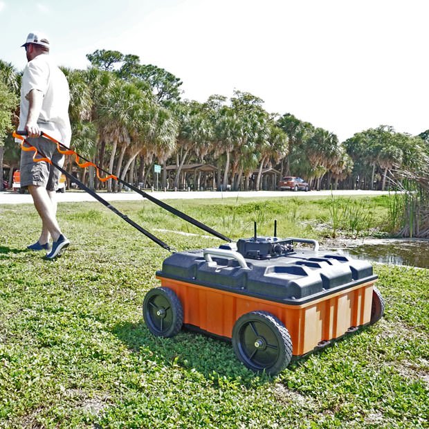
The wheel kit is compatible for the 200 HS antenna and future GS Series antennas. This kit comes with 4 wheels and proper mounting brackets to attach onto the antenna. The wheel kit will help decrease the wear on the bottom of the antenna and is built for easier travel in high wear data collection areas such as asphalt and concrete.

GS Series Transit Case
This custom foam Pelican Case is designed for the GS Series accessories. This transit case holds the HS Module, Panasonic Toughpad Tablet, SIR 4000 WiFi Module, optional wheel kit, tow handle, batteries and battery charger.

This custom foam Pelican Case is designed for the GS Series accessories. This transit case holds the HS Module, Panasonic Toughpad Tablet, SIR 4000 WiFi Module, optional wheel kit, tow handle, batteries and battery charger.

Model 620 Survey Wheel
The Model 620 survey wheel provides distance encoding and precise linear positioning along a transect. This survey wheel is appropriate for all mid-to-low frequency antennas.

The Model 620 survey wheel provides distance encoding and precise linear positioning along a transect. This survey wheel is appropriate for all mid-to-low frequency antennas.

EMLID Reach RS2+
The Reach RS2+ is a survey-grade-capable GPS that operates as a single unit or in base/rover mode with two units. The RS2+ is compatible with UtilityScan, UtilityScan Pro, UtilityScan DF/HS, 200 HS antenna, RoadScan, and PaveScan 2.0.
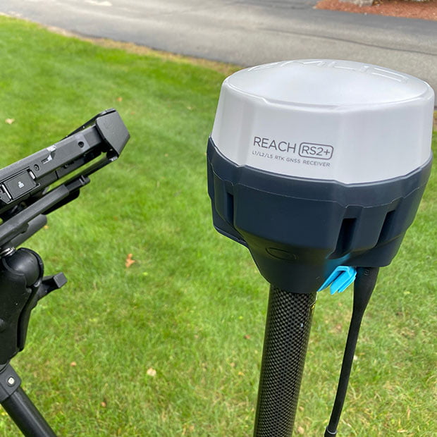
The Reach RS2+ is a survey-grade-capable GPS that operates as a single unit or in base/rover mode with two units. The RS2+ is compatible with UtilityScan, UtilityScan Pro, UtilityScan DF/HS, 200 HS antenna, RoadScan, and PaveScan 2.0.
Please provide the following information and we will contact you shortly.
If you prefer, call 603-864-0847. If you need to contact Training, click here.