
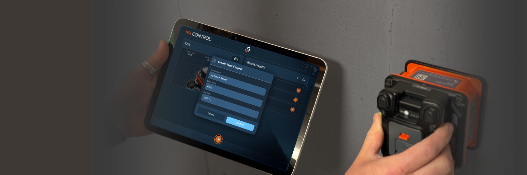
NX™ Control gives every user an easy yet powerful tool to collect, view, and share GPR and project data. With just one app to learn across NEXUS-enabled systems, organizations can reduce training time, increase productivity, and lower costs.
DEVICE FREEDOM
Download NX Control on your own iOS or Android mobile device rather than purchasing a dedicated controller, reducing cost and simplifying device management.
FASTER USER ADOPTION
One intuitive workflow across multiple GSSI devices helps new operators become productive quickly and accelerate return on investment.
SIMPLIFIED TRAINING
Train crews on one interface rather than multiple software platforms, making it easier to deploy personnel across projects and applications.
OPERATIONAL CONSISTENCY
A common user experience reduces errors, improves confidence, and eliminates the need to learn different systems as your capabilities expand.
ALWAYS UP TO DATE
It's easy to stay current with new features and enhancements delivered through regular app updates.
FUTURE-READY INVESTMENT
As the NEXUS ecosystem grows, users continue to benefit from familiar workflows and a shared platform experience.
The NX Control app is available on the Apple App Store or Google Play.


NX Control
changes the game.
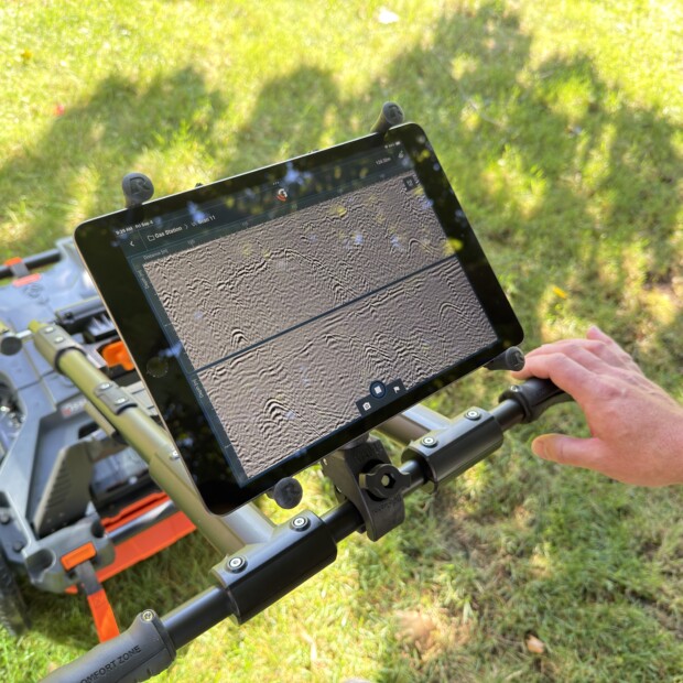
With a single app, operators can move between GSSI systems with confidence while minimizing the learning curve. The result is a simple and scalable approach to GPR.
- Faster onboarding for new users
- Less time spent on training and retraining
- Greater workforce flexibility
- Consistent workflows across applications
- Improved productivity in the field
From locating utilities and scanning concrete to exploring new applications, NX Control gives you the features you want and the flexibility you need.
-
 UTILITY LOCATING
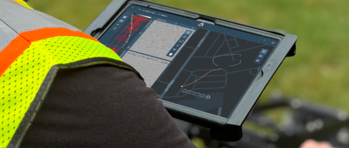
NX Control is included with Compass NX utility locating systems, delivering a new standard of simplicity and performance to utility professionals everywhere.
- Quickly toggle between antennas or view simultaneously
- Easy GPS setup and downloadable basemaps
- On-the-fly filters to enhance real-time decision making
-
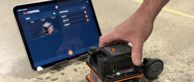 CONCRETE SCANNING
Pair NX Control with NX15 and NX25 systems to streamline concrete inspection and tackle the toughest scanning jobs.
- Choose your mode: QuickScan for fast, one-button scanning or Project Mode for file management and complex workflows
- Toggle real-time filters to focus on what matters most
- Capture photos and data images in the app for easy export
-
 EMERGING NEXUS PRODUCTS
As new products and applications are introduced, your organization can continue leveraging the same familiar workflows and user experience.
- Faster adoption of new technology and capabilities
- Greater investment protection with continual development
- Scalable platform architecture that adapts to emerging needs

Have questions about NX Control? Get quick and easy access to our Customer Service team. This service is available during business hours 8:30 AM to 5:00 PM EST.
If you have a question that isn’t answered here, please contact us and we’ll be happy to help.
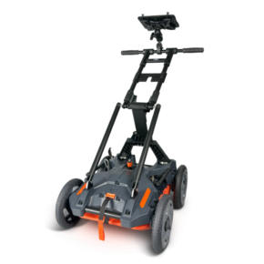
Nexus-based systems are compatible with NX Control. These include Compass NX, NX25, and NX15.
We recommend using a modern 9-inch to 10.5-inch iOS or Android tablet that is still eligible for operating system and security updates. We recommend a minimum of 128GB of storage for your phone or tablet.
No, NX Control is built around offline capabilities so you do not have to have an active internet connection during fieldwork.
No, NX Control is only available for iOS (Apple) and Android devices.
Yes, but please be aware that some mobile devices do not have GPS capabilities. Additionally, the GPS in many mobile devices does not generate high precision location information. GSSI recommends using an external GPS for achieving better precision.
Many modern GPS units will work with Compass NX but if you are using NX Control on iOS, you’ll need a GPS that communicates using BLE Bluetooth protocol. NX Control on Android can use GPS units that communicate using SPP and BLE Bluetooth protocols.
NX Control is a native iOS and Android app, so updates will be delivered through the app stores. We recommend allowing the NX Control app to automatically update. Release notes are located in Settings > About.
Exported NX Control scan data are saved in a new .NX file format. This format is natively supported in Geolitix (https://www.geolitix.com/), and includes raw (unprocessed) scan data, GPS and geospatial positions, User Marks, and Target Marks.
The .DZT format has been superseded by the .NX file format. NX Control will not output traditional .DZT, .DZX, .DZG, or other traditional file formats.
Projects are exported as a .zip archive with the name of the project. Once extracted, the directory structure follows the following format:
- Project Name folder
- AOI Folders with AOI Names
- AOI Folders contain:
- .NX files that include raw GPR data and geospatial data
- .PNG screengrabs and photos that were imported to the project using ‘Add Result’
- AOI Folders contain:
No, and there are no plans for RADAN 7 compatibility for NX Control data.
Yes – the map displays all GPS track lines for all GPS-encoded scans in the current project.
The currently active GPS track line (for live scans and scans in playback) is orange and inactive/saved track lines are blue.
The QuickScan survey parameters are identical to Project Mode. However, QuickScan does not save scan data and does not permit the placement of Target Marks on scan data.
The time range is fixed at a value unique to the connected antenna model . A combination of vertical and horizontal scaling, as well as fixed aspect ratio zoom, allows customization of the scan data display. These parameters persist until changed, even after closing and reopening NX Control.
NX Control currently supports .KMZ export for GPS track lines and Target Marks.
 NX Control 2-Page Brochure
 NX Control Technical Support Page
Please provide the following information and we will contact you shortly.
If you prefer, call 603-864-0847. If you need to contact Training, click here.