Archaeology & Forensics

Archaeology & Forensics
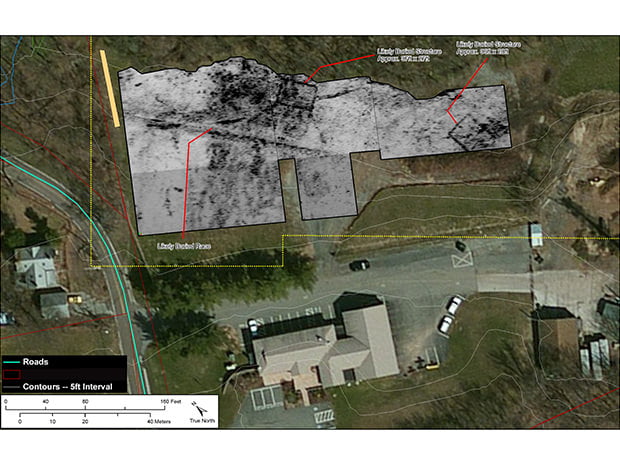
Archaeologists and remote sensing specialists around the world rely on GSSI ground penetrating radar (GPR) as a key tool for non-invasive site investigation. Whether the goal is site mapping for excavation or locating sensitive cultural resources for preservation or avoidance, GSSI's remote sensing technologies have been the tools of choice for over 50 years.
GPR is used by law enforcement and crime scene investigators to locate clandestine burials and buried objects. GPR has been instrumental in locating victims, hidden caches of weapons or evidence, and helping to locate the remains of soldiers and civilians killed in war zones.
GPR is used by law enforcement and crime scene investigators to locate clandestine burials and buried objects. GPR has been instrumental in locating victims, hidden caches of weapons or evidence, and helping to locate the remains of soldiers and civilians killed in war zones.
Archaeology
- Excavation Planning
- Cemetery Mapping
- Cultural Resource Management
Forensics
- Evidence Locating
- Clandestine Grave Locations

Archaeology


Forensics
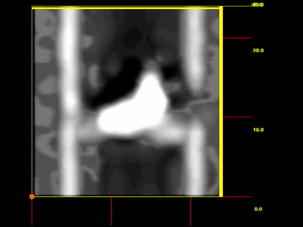

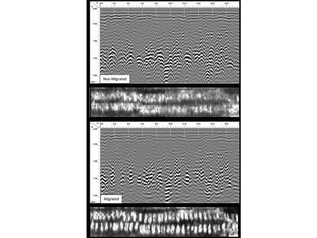
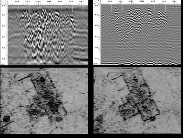
Data Processing