Products
Flex NX
Flex NX
StructureScan
StructureScan Pro
StructureScan Mini XT
StructureScan Mini LT
UtilityScan
GSSI’s Utility Scan Pro GPR
UtilityScan
UtilityScan DF
PaveScan RDM 2.0
RoadScan
BridgeScan
GS Series
200 HS Antenna
SIR Systems
SIR 4000
SIR 30
LifeLocator TRx
Antennas
RADAN Software
Accessories
View All
Solutions
Concrete Inspection
Utility Locating & Mapping
Transportation
Environmental
Geology & Geophysics
Archaeology & Forensics
Search & Rescue
View All
Innovation Lab
Our Approach
Our Process
Our Lab
GSSI Academy
Training Schedule
Why Train at GSSI
Upcoming Events
Technology Explained
What Is GPR?
What is EM?
What is UWB?
Resources
Meet the Trainers
Contact Training
Support
Call Support
Helpful Resources
Email Support
Download Resources
FAQ’s
Regulatory Information
Contact
Where We’re Located
Call GSSI
Local Accomodations
Rental Companies
Email GSSI
Upcoming Shows and Conferences
Finance Information
About GSSI
Careers
GSSI News
Products
Flex NX
Flex NX
Flex NX®, powered by Nexus™ is the industry’s most powerful and complete concrete scanning system. Use Flex NX™ on its own, or pair an NX wireless satellite antenna to be ready for any jobsite challenge.
Structurescan
StructureScan Pro
Structurescan Pro
The StructureScan Pro is a versatile concrete inspection system based on the SIR 4000, and offers a wide variety of antenna options for concrete applications.
StructureScan Mini XT
Structurescan Mini XT
The StructureScan™ Mini XT is the tool designed for today’s professional concrete scanner and built to handle all your job site and survey needs.
StructureScan Mini LXT
StructureScan Mini LXT
The StructureScan™ Mini LXT is designed and built for the concrete contractor who needs to locate and mark targets in concrete.
UtilityScan
UtilityScan Pro
UtilityScan Pro
The UtilityScan Pro is a versatile utility locating system based on the SIR 4000, and offers several options for customization.
UtilityScan
UtilityScan
UtilityScan is an indispensable tool for utility locating professionals around the world to easily and accurately map utilities in real-time.
UtilityScan DF
UtilityScan DF
The UtilityScan DF incorporates our innovative dual-frequency digital antenna (300/800 MHz) and a touchscreen interface to view shallow and deep targets simultaneously in a single scan.
PaveScan
PaveScan RDM 2.0
PaveScan RDM 2.0
The PaveScan RDM uses the dielectric measurements of new pavement to determine pavement quality and uniformity.
PaveScan MDM
PaveScan MDM
PaveScan Mix Design Module (MDM) is a powerful new tool for QA/QC labs.
RoadScan
RoadScan
The RoadScan™ 30 system is based on the SIR 30 and provides users with an effective tool for quickly determining pavement layers at high speeds.
BridgeScan
BridgeScan
The BridgeScan™ is a complete, affordable GPR system that is an effective tool for quickly determining the condition of aging bridge decks.
GS Series
200 HS Antenna
The 200 HS digital, wireless antenna is ideal for geophysical, geotechnical, and environmental applications that require high reliability under challenging survey conditions.
SIR Systems
SIR 4000
SIR 4000
The SIR® 4000 is GSSI’s first high-performance GPR data acquisition system designed to operate with analog and digital antennas.
SIR 30
SIR 30
The SIR® 30 is the next-generation multi-channel GPR control unit. This system can collect up to eight channels of data simultaneously with uncompromised performance.
Antennas
Software
Accessories
View All
Not sure which product is right for you?
Let us help you decide »
Solutions
Concrete Inspection
Concrete Inspection
Cutting and coring experts and construction professionals require a reliable, non-destructive solution to assess concrete and concrete structures.
Utility locating
Utility locating
Utility locators, construction professionals, environmental firms and land surveyors need to know about underground assets prior to digging and trenching efforts.
Transportation
Transportation
Highway professionals, engineers and transportation departments require a safe, reliable and non-destructive method to evaluate roads and bridges.
Environmental
Environmental
The key to a comprehensive environmental assessment is the subsurface investigation.
Geology & Geophysics
Geology & Geophysics
Ground penetrating radar (GPR) offers an accurate, non-destructive solution to mapping the subsurface of the earth.
Archaeology & Forensics
Archaeology & Forensics
Archaeologists and remote sensing specialists around the world rely on GSSI ground penetrating radar as a key tool for non-invasive site investigation.
View All
Innovation Lab
Our Approach
Our Process
Our Lab
GSSI Academy
Training Schedule
Why Train at GSSI
Upcoming Events
Technology Explained
What Is GPR?
What is EM?
What is UWB?
Resources
Meet the Trainers
Contact Training
Support
Call Support
Helpful Resources
Email Support
Download Resources
FAQ’s
Regulatory Information
Patents
Contact
Where We’re Located
Call GSSI
Local Accommodations
Rental Companies
Email GSSI
Upcoming Shows
Finance Information
Contact Us
Gallery
Upload photo
Rules & Prizes
Your Images
Log in
Newest
Oldest
Most voted
Least voted
Random
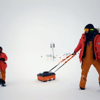
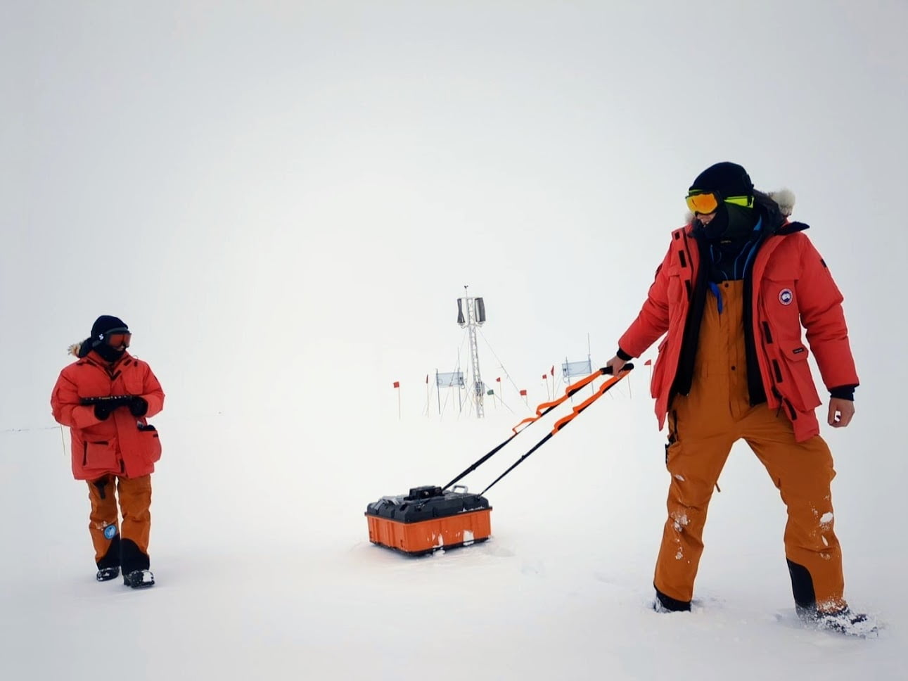
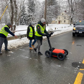
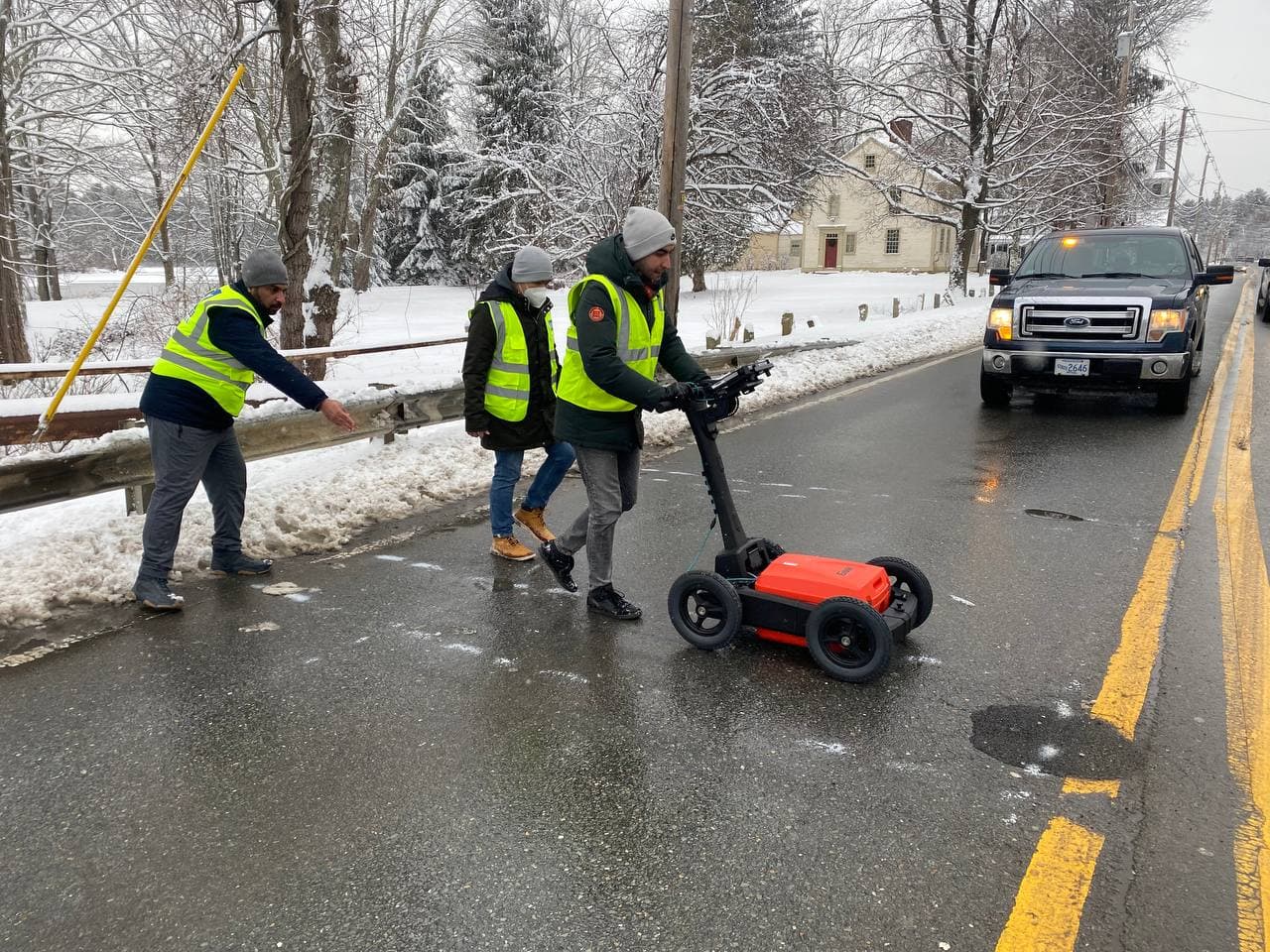
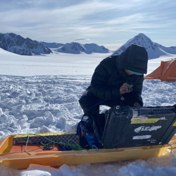
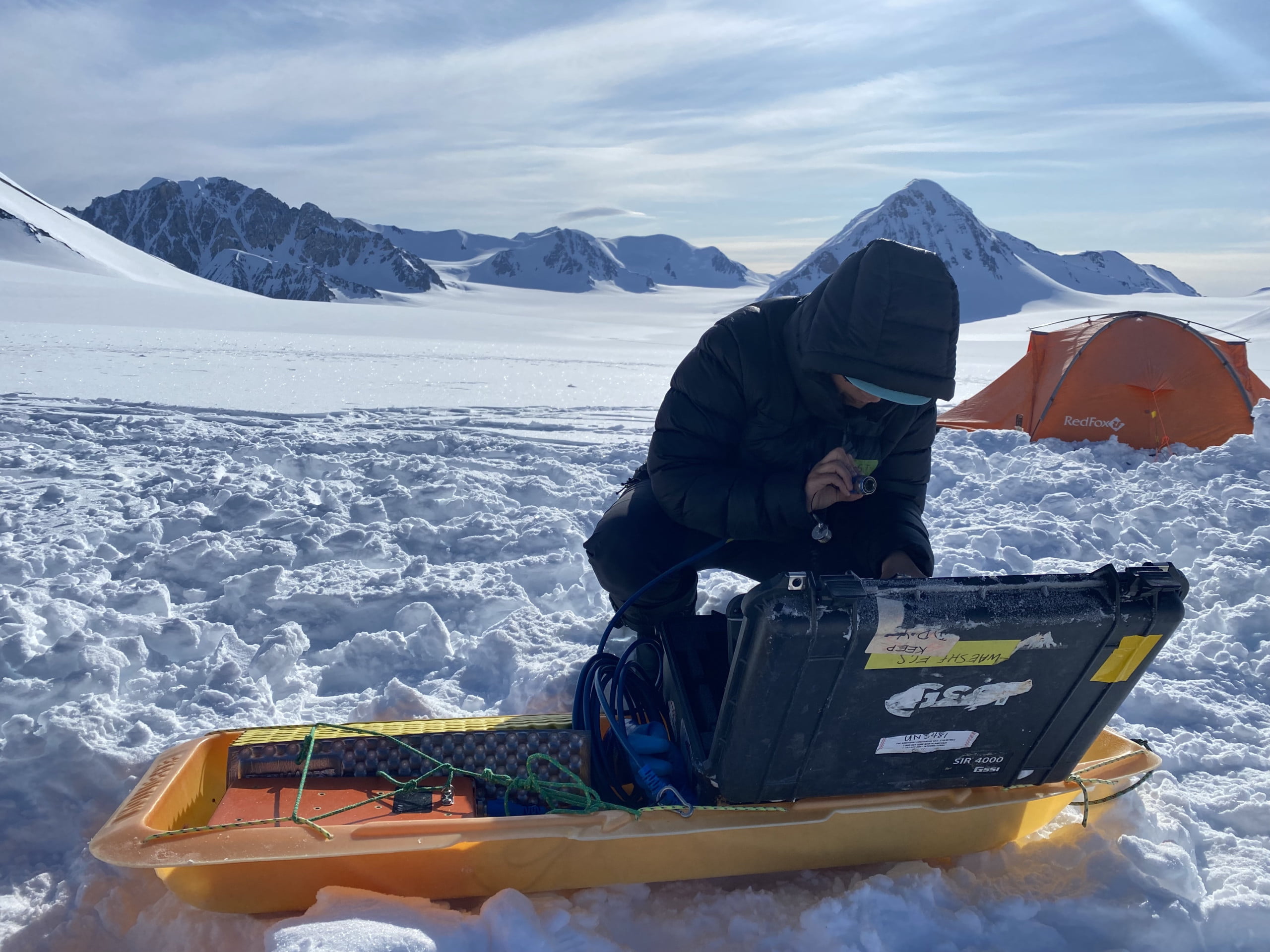
Survey of an arctic ice sheet
sdk_rnog
No Category
203
6
Survey of an arctic ice sheet
sdk_rnog
No Category
203
6
Survey of an arctic ice sheet
Author: sdk_rnog
Votes: 6
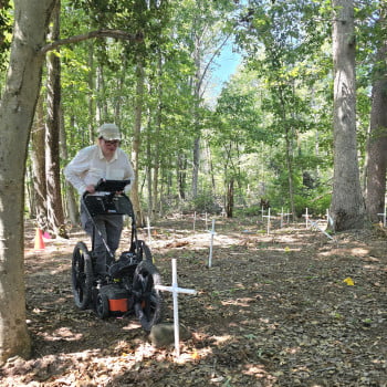
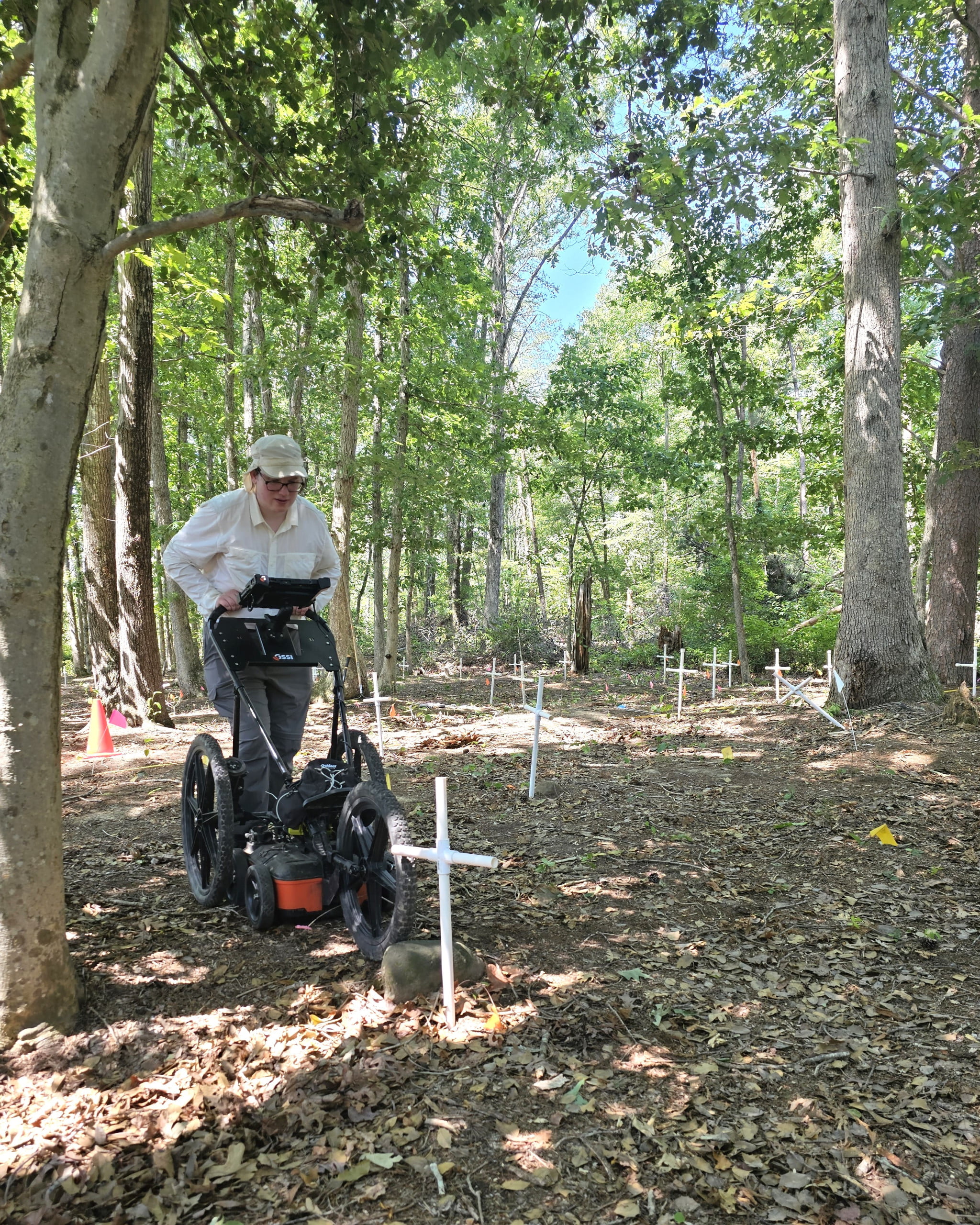
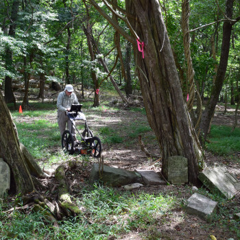
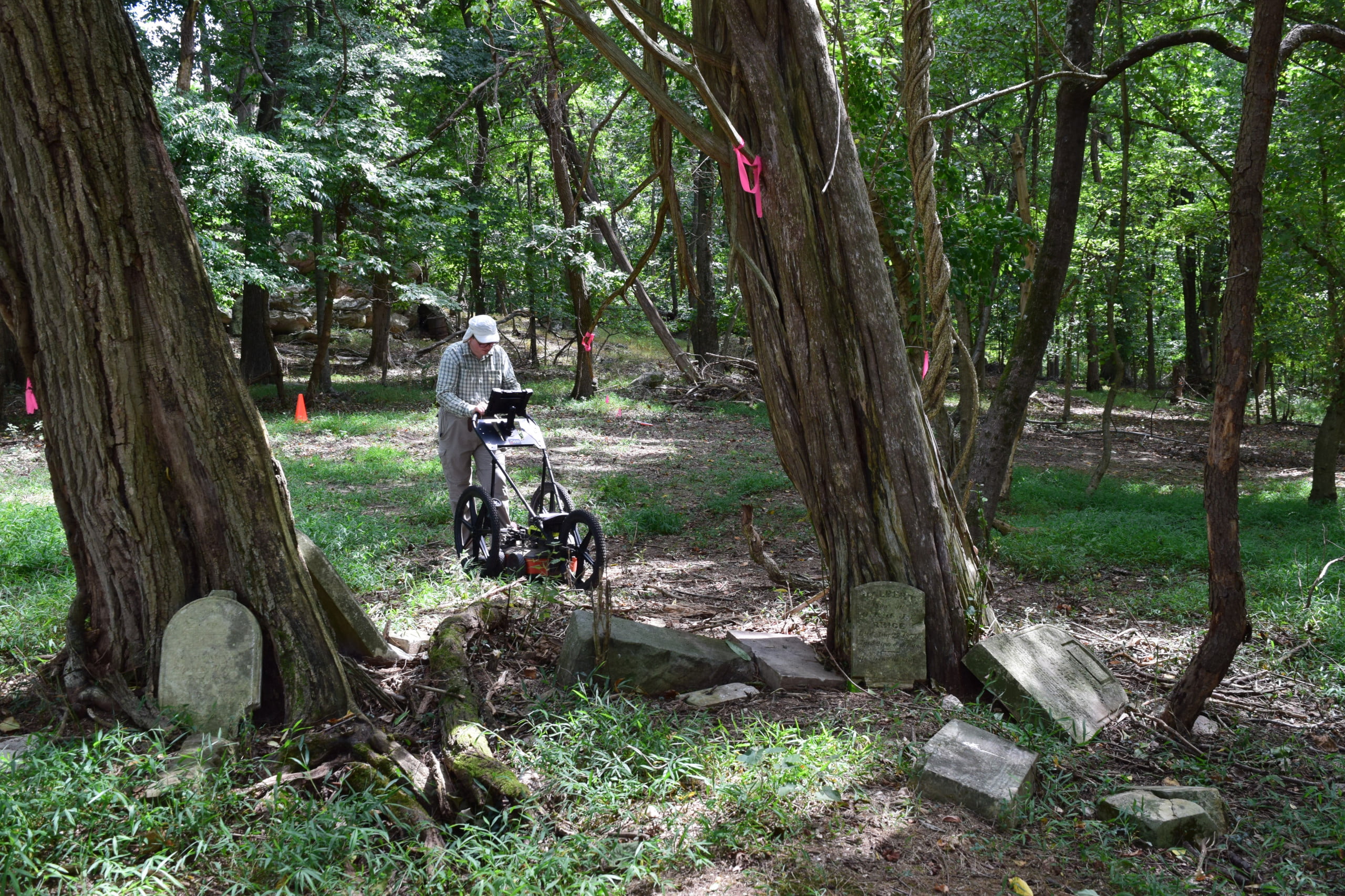
Carroll Cemetery GPR Survey
KathleenC
No Category
165
0
Carroll Cemetery GPR Survey
KathleenC
No Category
165
0
Carroll Cemetery GPR Survey
Author: KathleenC
Votes: 0
Endless Fields, GPR Survey, Maryland
KathleenC
No Category
155
0
Endless Fields, GPR Survey, Maryland
KathleenC
No Category
155
0
Endless Fields, GPR Survey, Maryland
Author: KathleenC
Votes: 0
Aeration Basin Assessment - Surface Penetrating Radar (SPR)
Farshad Malek
No Category
144
0
Aeration Basin Assessment - Surface Penetrating Radar (SPR)
Farshad Malek
No Category
144
0
Aeration Basin Assessment - Surface Penetrating Radar (SPR)
Author: Farshad Malek
Votes: 0
Filter Gallery - Surface Penetrating Radar for Half-Cell Potential Testing
Farshad Malek
No Category
155
1
Filter Gallery - Surface Penetrating Radar for Half-Cell Potential Testing
Farshad Malek
No Category
155
1
Filter Gallery - Surface Penetrating Radar for Half-Cell Potential Testing
Author: Farshad Malek
Votes: 1
Filter Gallery - Surface Penetrating Radar for Half-Cell Potential Testing
Farshad Malek
No Category
149
0
Filter Gallery - Surface Penetrating Radar for Half-Cell Potential Testing
Farshad Malek
No Category
149
0
Filter Gallery - Surface Penetrating Radar for Half-Cell Potential Testing
Author: Farshad Malek
Votes: 0
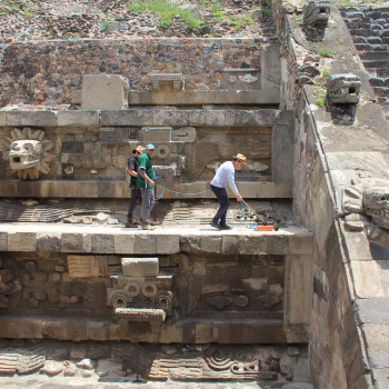
Feathered Serpent
Jose Ortega
No Category
319
14
Feathered Serpent
Jose Ortega
No Category
319
14
Feathered Serpent
Author: Jose Ortega
Votes: 14
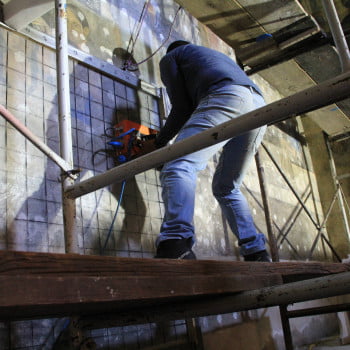
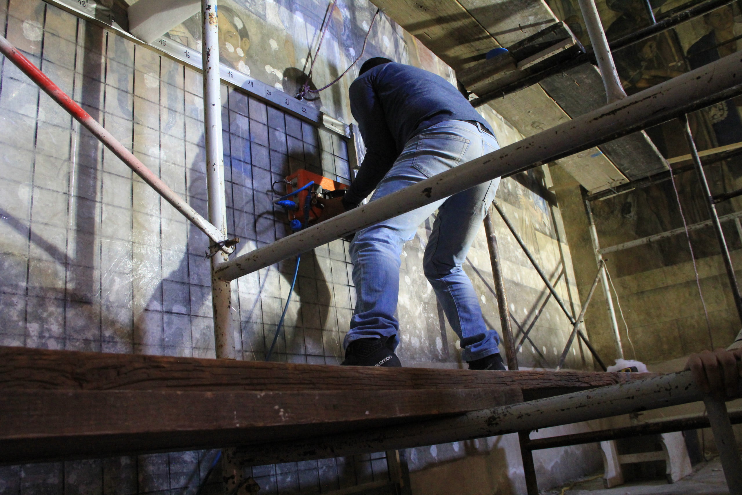
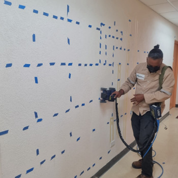
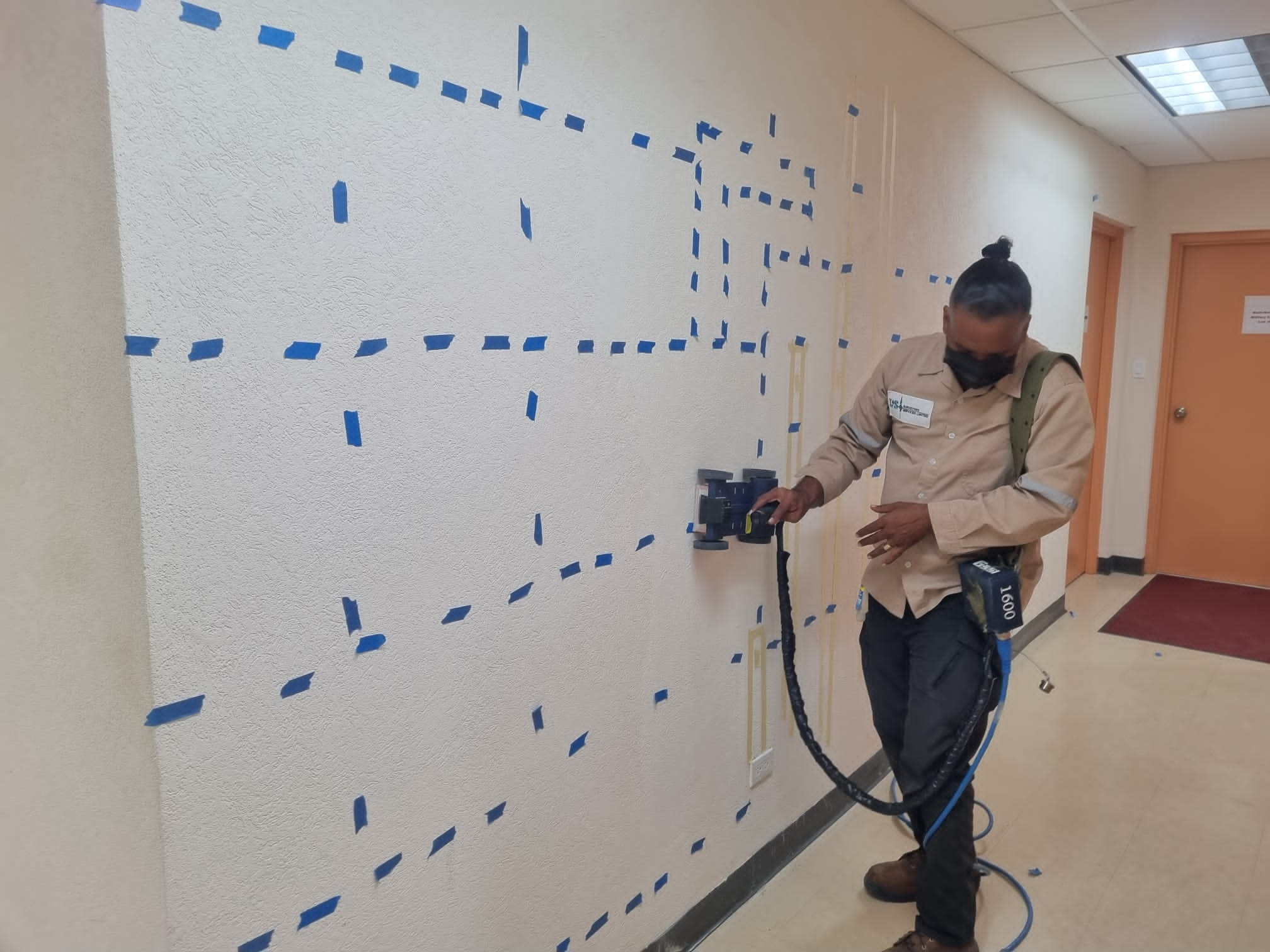
Mural suyvey
Jose Ortega
No Category
208
2
Mural suyvey
Jose Ortega
No Category
208
2
Mural suyvey
Author: Jose Ortega
Votes: 2
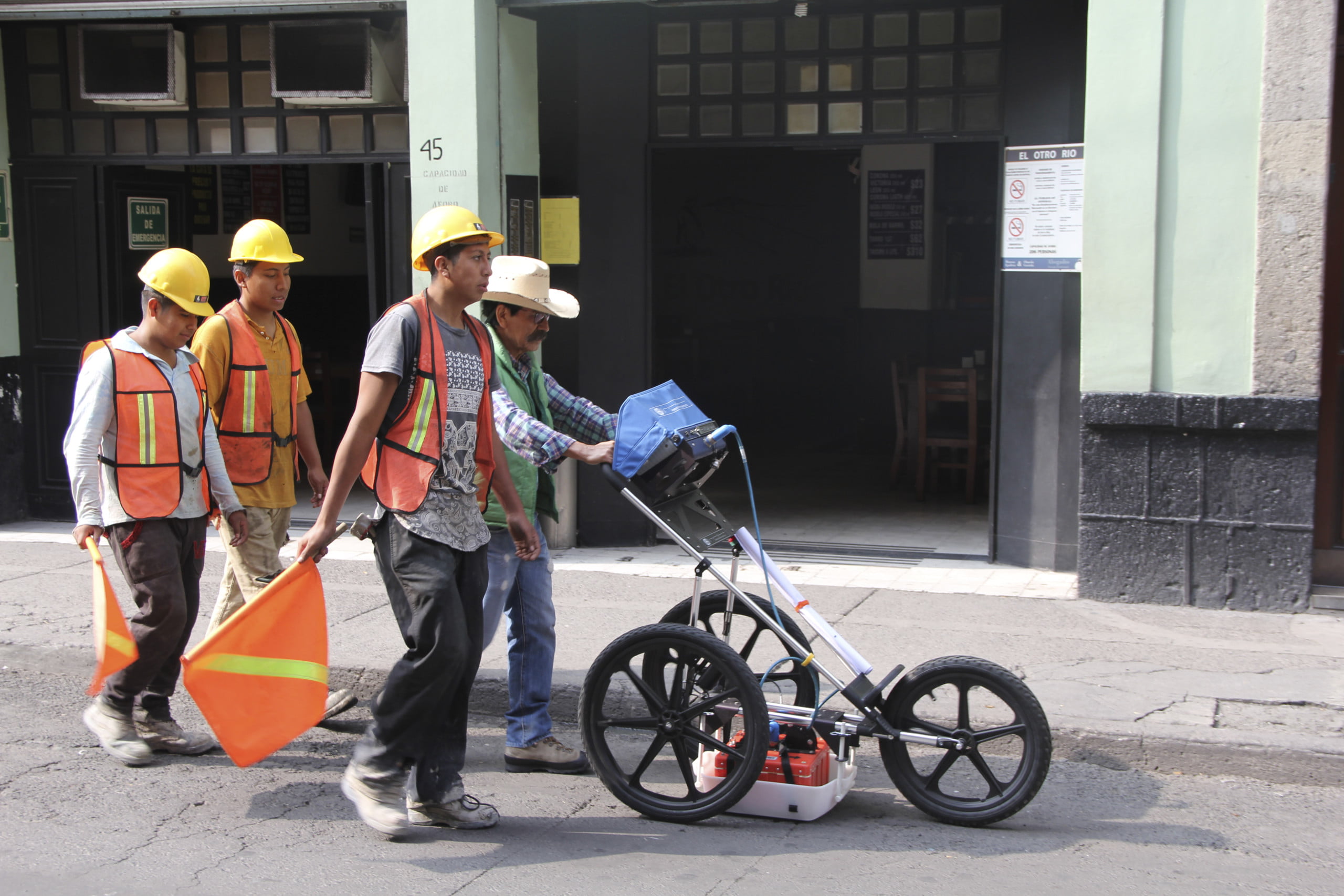
Survey city
Jose Ortega
No Category
164
1
Survey city
Jose Ortega
No Category
164
1
Survey city
Author: Jose Ortega
Votes: 1
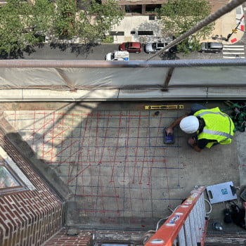
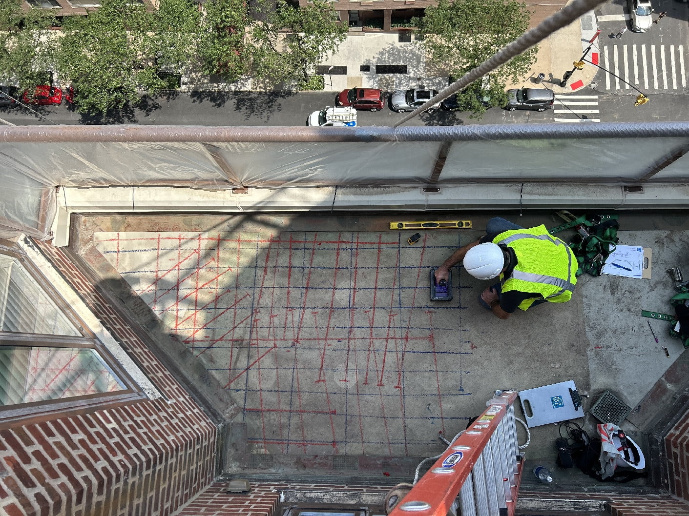
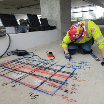
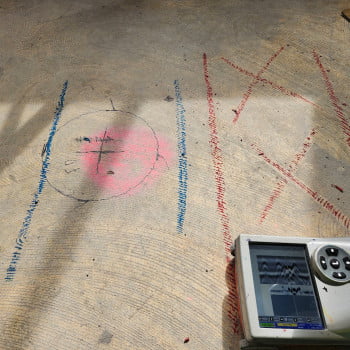
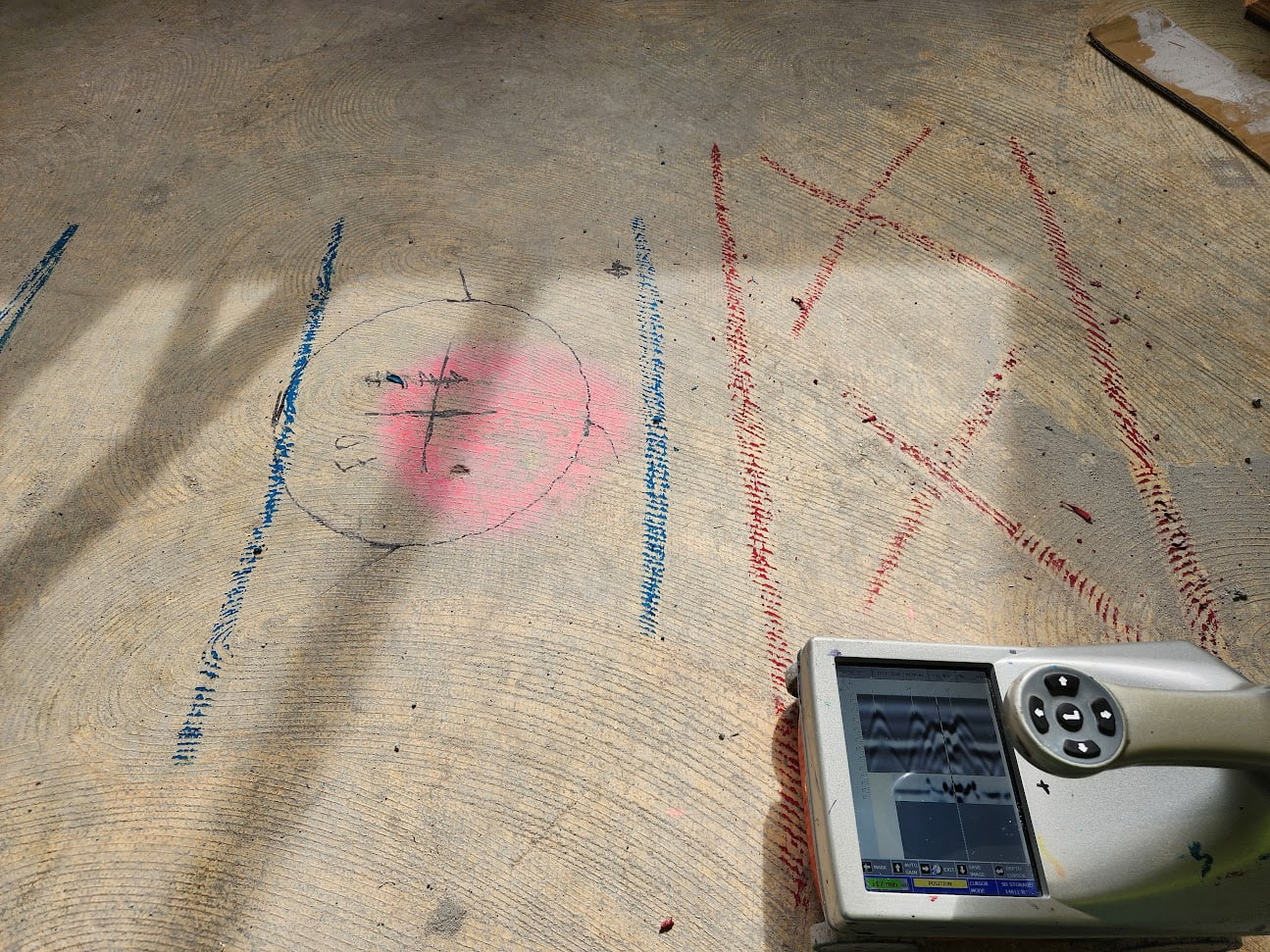
Concrete Analysis for delamination, rebar layout, and depth of cover
Forrest Sim
No Category
223
2
Concrete Analysis for delamination, rebar layout, and depth of cover
Forrest Sim
No Category
223
2
Concrete Analysis for delamination, rebar layout, and depth of cover
Author: Forrest Sim
Votes: 2
SIR 4000 in Armenia
Lance Finlayson
No Category
184
3
SIR 4000 in Armenia
Lance Finlayson
No Category
184
3
SIR 4000 in Armenia
Author: Lance Finlayson
Votes: 3
GSSI SIR 4000 in Armenia
Lance Finlayson
No Category
169
3
GSSI SIR 4000 in Armenia
Lance Finlayson
No Category
169
3
GSSI SIR 4000 in Armenia
Author: Lance Finlayson
Votes: 3
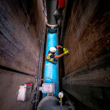
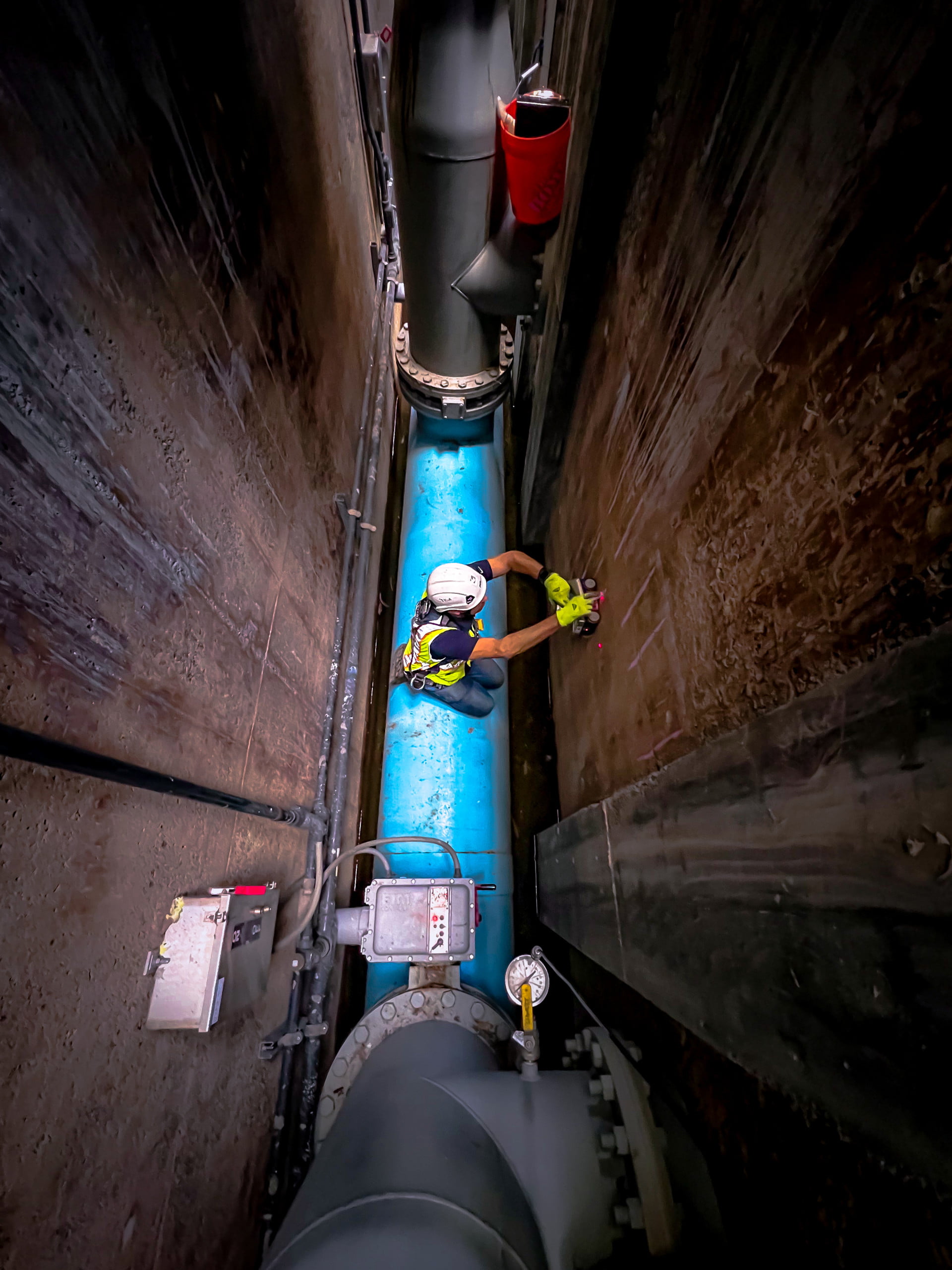
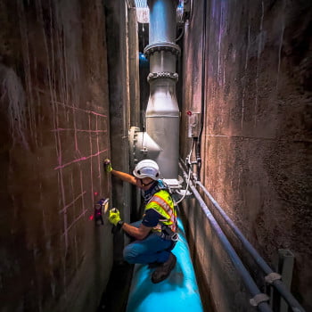
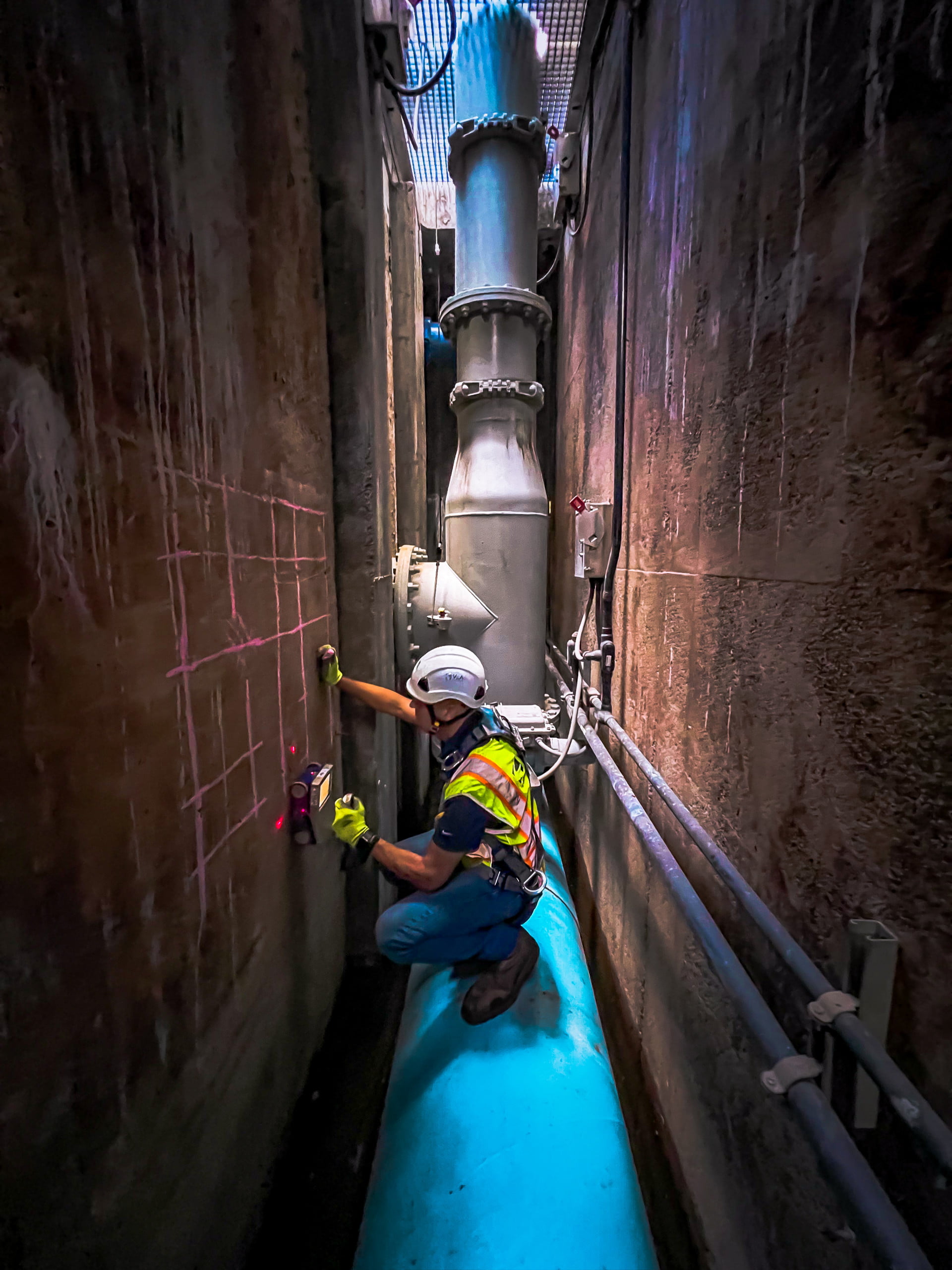
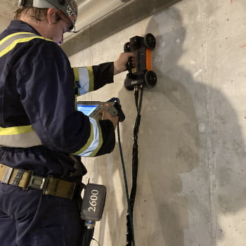
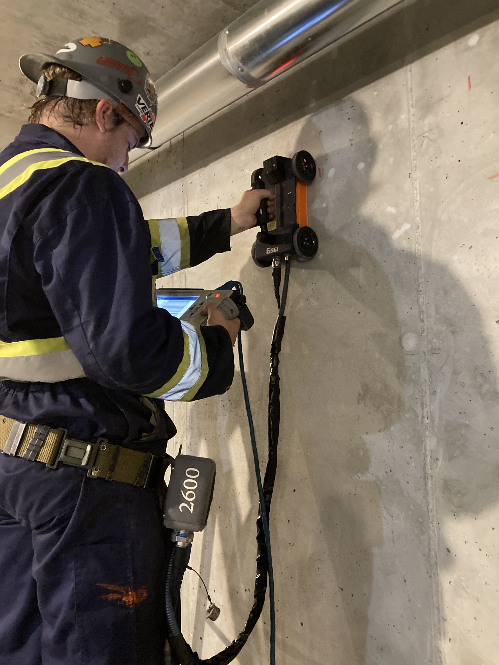
Concrete scanning
Terry Doherty
No Category
145
0
Concrete scanning
Terry Doherty
No Category
145
0
Concrete scanning
Author: Terry Doherty
Votes: 0
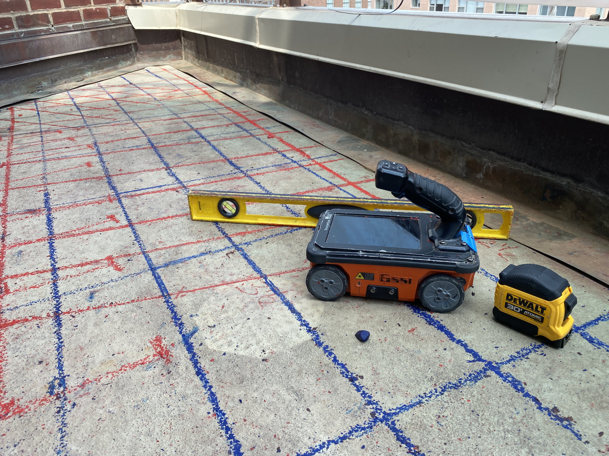
Mapping 'Spaghetti' - AKA Balcony Reinforcement
Charles Bransby-Zachary
No Category
170
1
Mapping 'Spaghetti' - AKA Balcony Reinforcement
Charles Bransby-Zachary
No Category
170
1
Mapping 'Spaghetti' - AKA Balcony Reinforcement
Author: Charles Bransby-Zachary
Votes: 1
The Mini Magic Little Box of Tricks!
Charles Bransby-Zachary
No Category
155
0
The Mini Magic Little Box of Tricks!
Charles Bransby-Zachary
No Category
155
0
The Mini Magic Little Box of Tricks!
Author: Charles Bransby-Zachary
Votes: 0
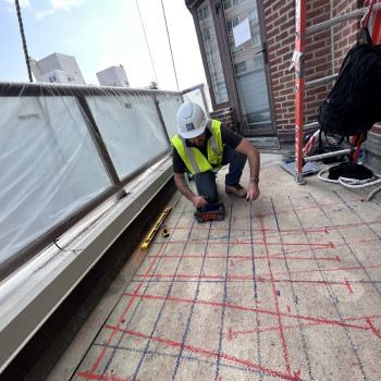
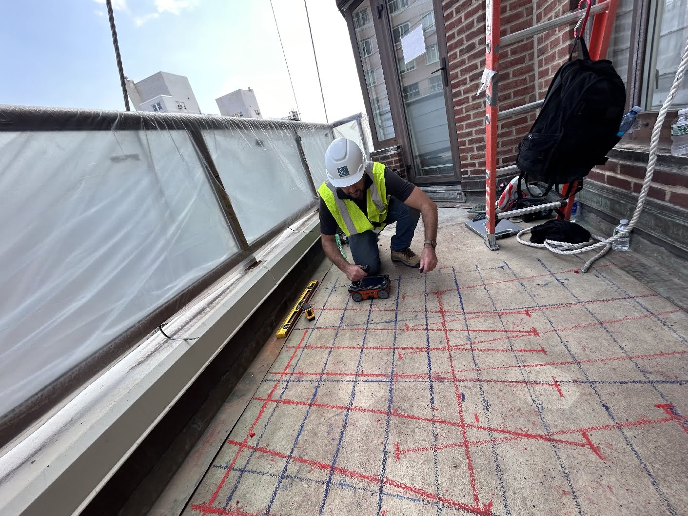
Balcony Assessments in NYC
Charles Bransby-Zachary
No Category
178
0
Balcony Assessments in NYC
Charles Bransby-Zachary
No Category
178
0
Balcony Assessments in NYC
Author: Charles Bransby-Zachary
Votes: 0
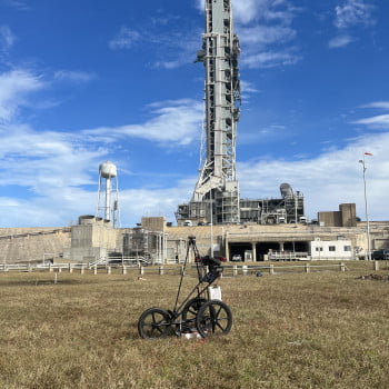
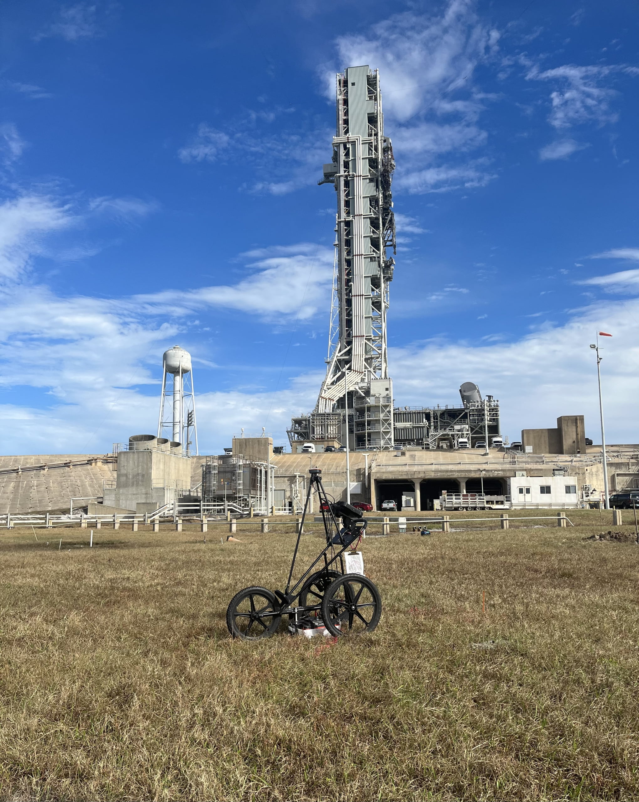
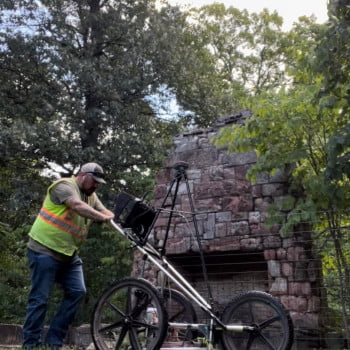
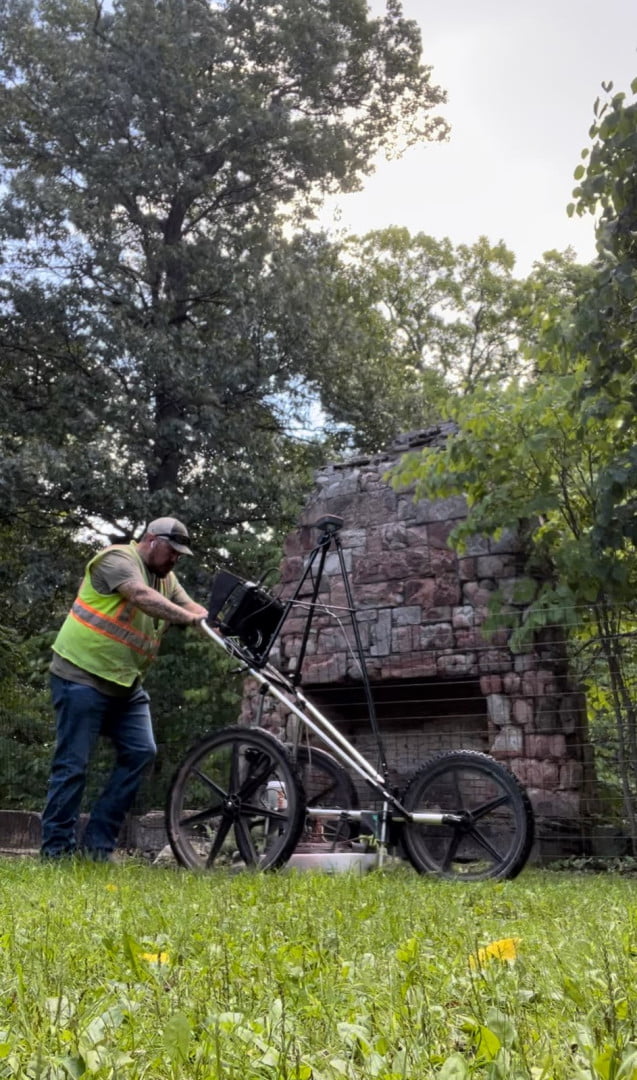
Kennedy Space Center Launch Complex 39b
Michael wood
No Category
181
1
Kennedy Space Center Launch Complex 39b
Michael wood
No Category
181
1
Kennedy Space Center Launch Complex 39b
Author: Michael wood
Votes: 1
Price Family Cemetery
KathleenC
No Category
207
2
Price Family Cemetery
KathleenC
No Category
207
2
Price Family Cemetery
Author: KathleenC
Votes: 2
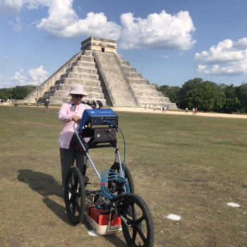
GPR Chichen Itza
Ana Caccavari
No Category
1531
203
GPR Chichen Itza
Ana Caccavari
No Category
1531
203
GPR Chichen Itza
Author: Ana Caccavari
Votes: 203
Void Detection Atop Retaining Wall
Bentley Thompson
No Category
340
0
Void Detection Atop Retaining Wall
Bentley Thompson
No Category
340
0
Void Detection Atop Retaining Wall
Author: Bentley Thompson
Votes: 0
3D Scanning Concrete Pad
Chris Post
No Category
253
2
3D Scanning Concrete Pad
Chris Post
No Category
253
2
3D Scanning Concrete Pad
Author: Chris Post
Votes: 2
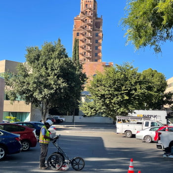
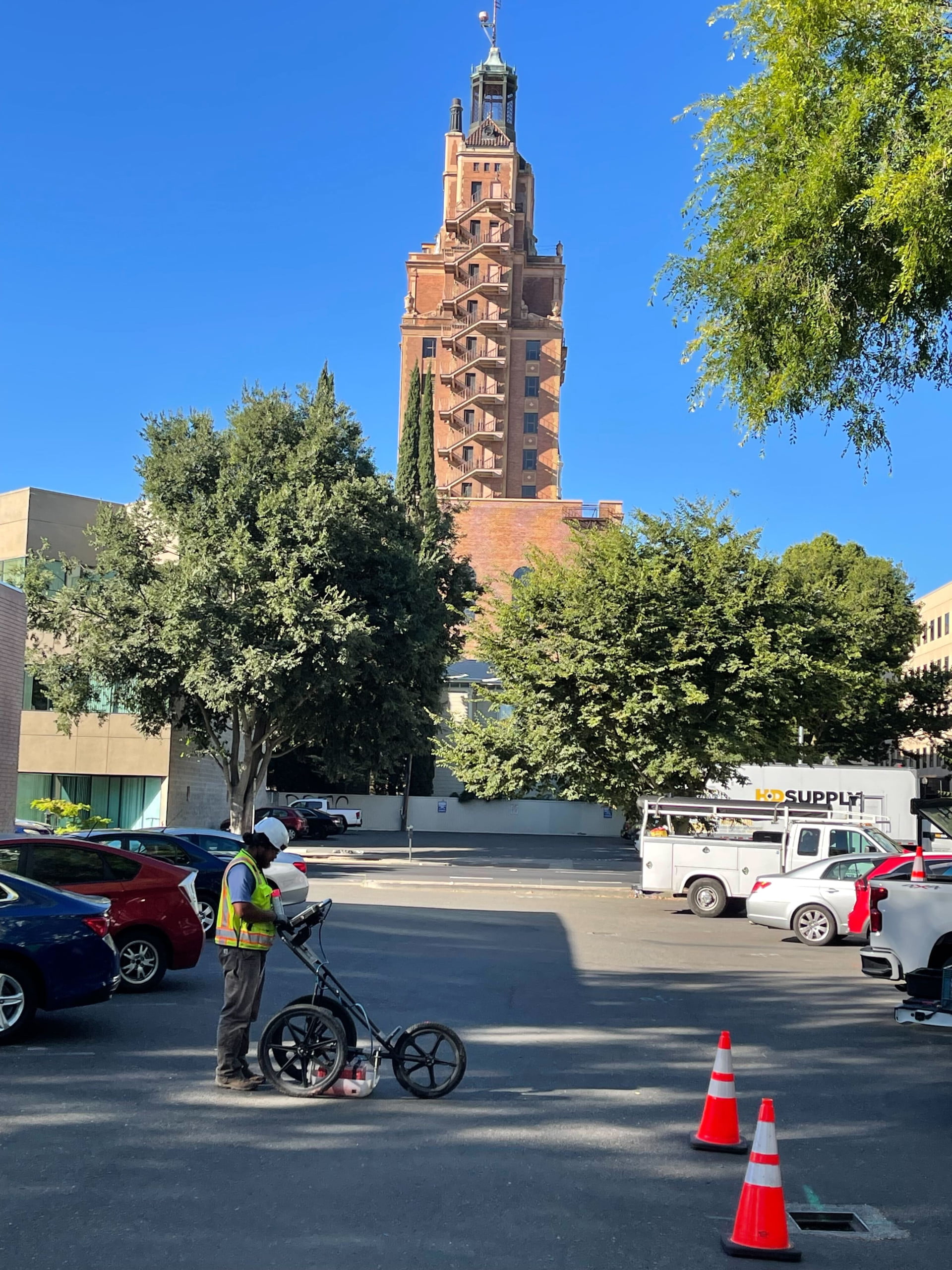
Downtown Sacramento GPR
Chris Post
No Category
217
4
Downtown Sacramento GPR
Chris Post
No Category
217
4
Downtown Sacramento GPR
Author: Chris Post
Votes: 4
Subsurface void detection
Koosha Raisi
No Category
194
0
Subsurface void detection
Koosha Raisi
No Category
194
0
Subsurface void detection
Author: Koosha Raisi
Votes: 0
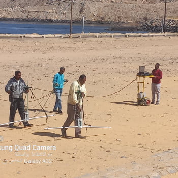
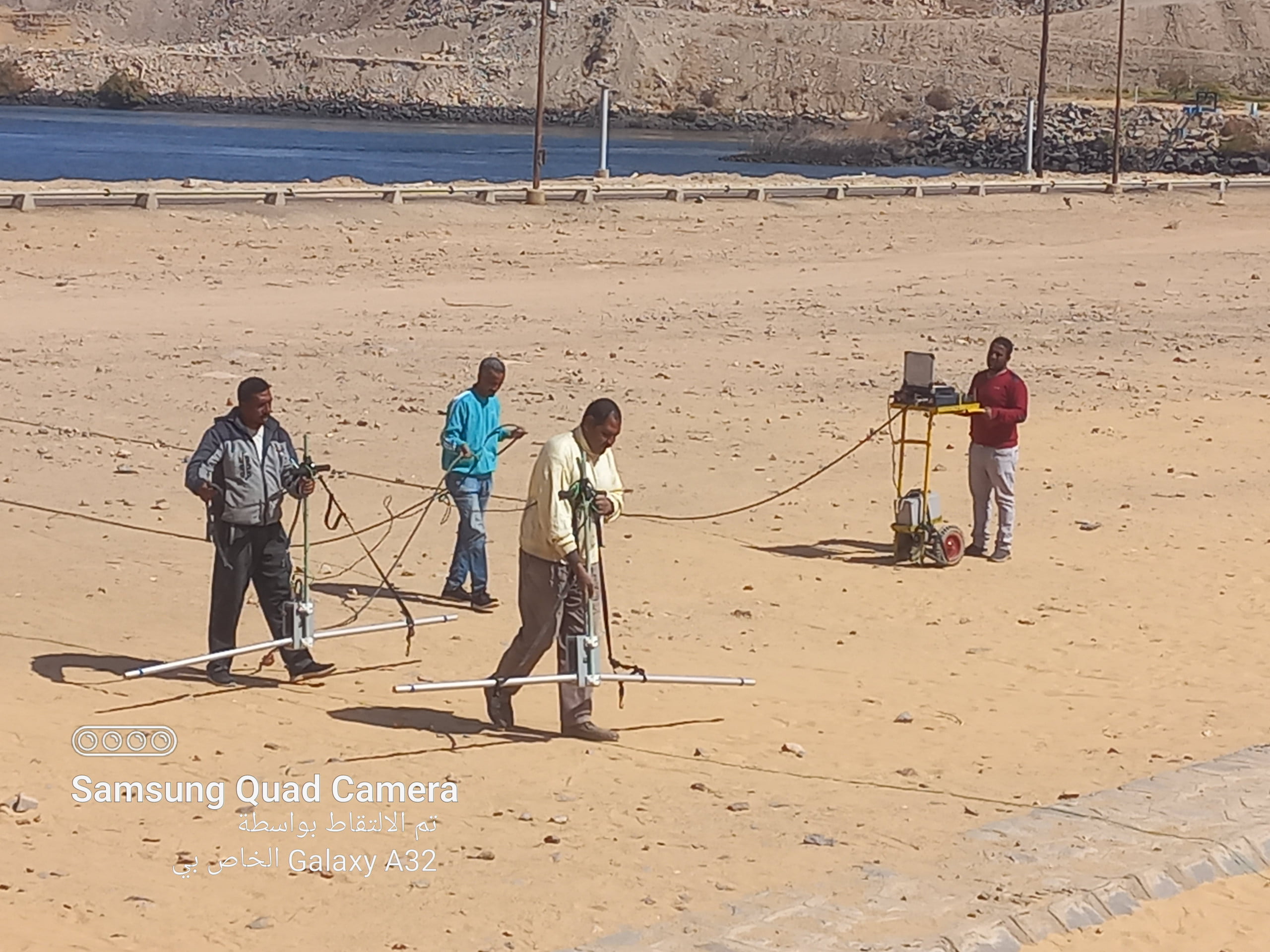
GPR survey at Amoun Island
Sayed Mohamed Ali
No Category
195
2
GPR survey at Amoun Island
Sayed Mohamed Ali
No Category
195
2
GPR survey at Amoun Island
Author: Sayed Mohamed Ali
Votes: 2
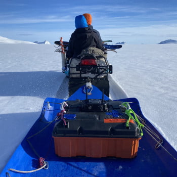
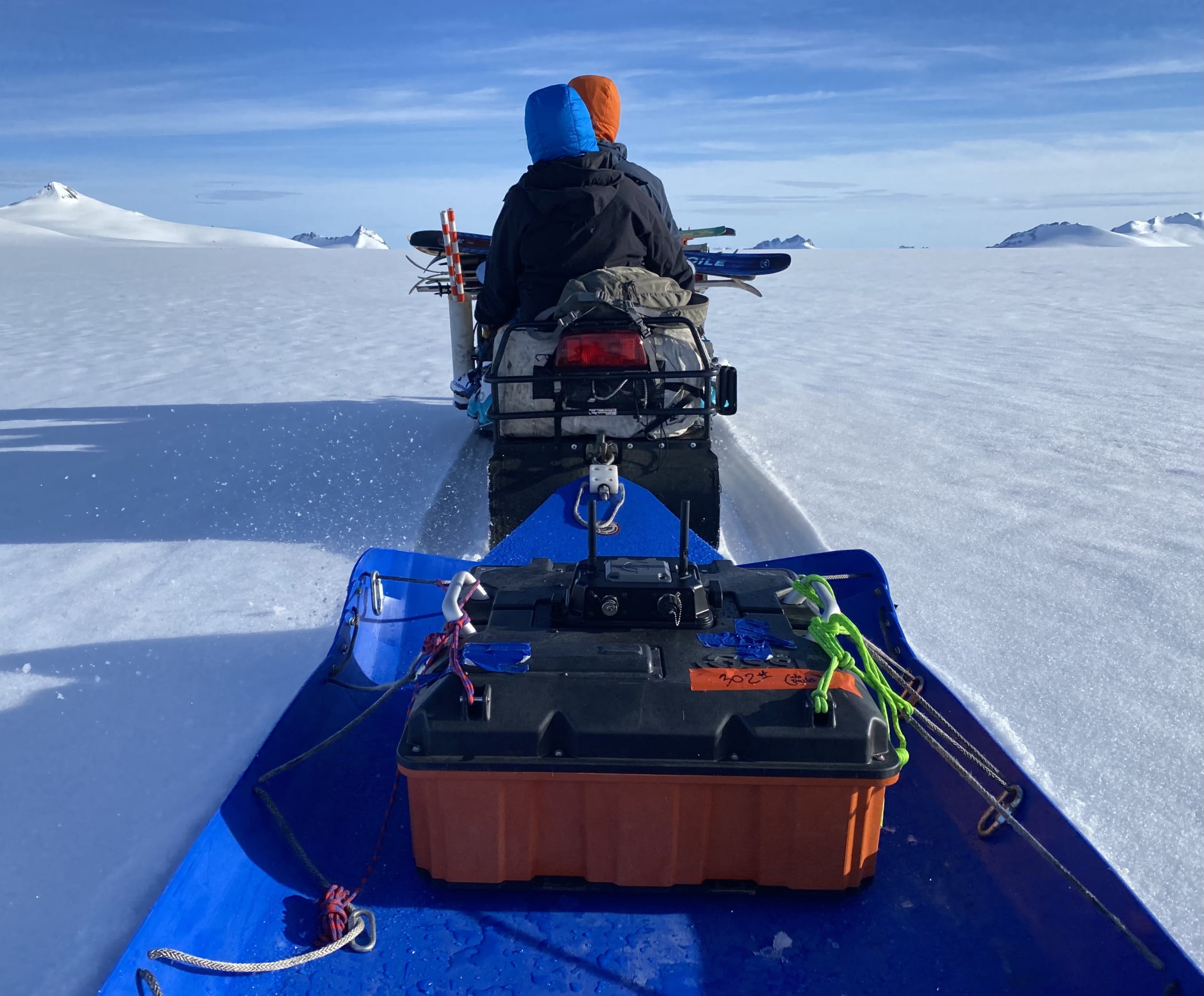
200 MHz HS Survey on the Juneau Icefield
Mikaila Mannello
No Category
213
3
200 MHz HS Survey on the Juneau Icefield
Mikaila Mannello
No Category
213
3
200 MHz HS Survey on the Juneau Icefield
Author: Mikaila Mannello
Votes: 3
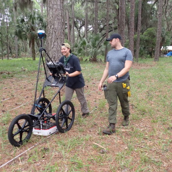
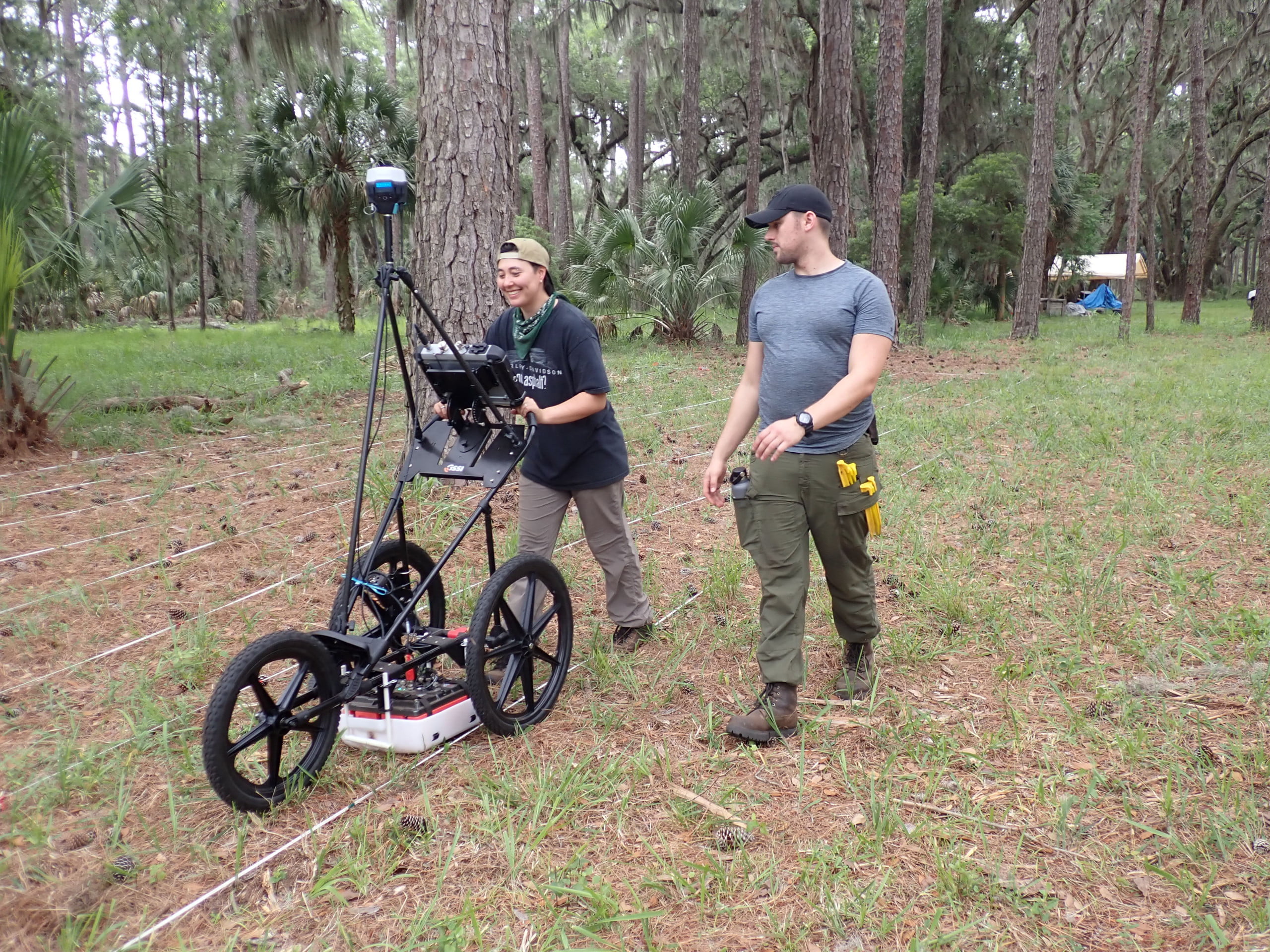
Recovering Worthington Cemetery through Community Archaeology, Defiance County, NW Ohio.
Eric Hubbard
No Category
1159
170
Recovering Worthington Cemetery through Community Archaeology, Defiance County, NW Ohio.
Eric Hubbard
No Category
1159
170
Recovering Worthington Cemetery through Community Archaeology, Defiance County, NW Ohio.
Author: Eric Hubbard
Votes: 170
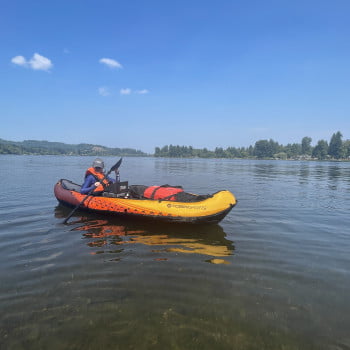
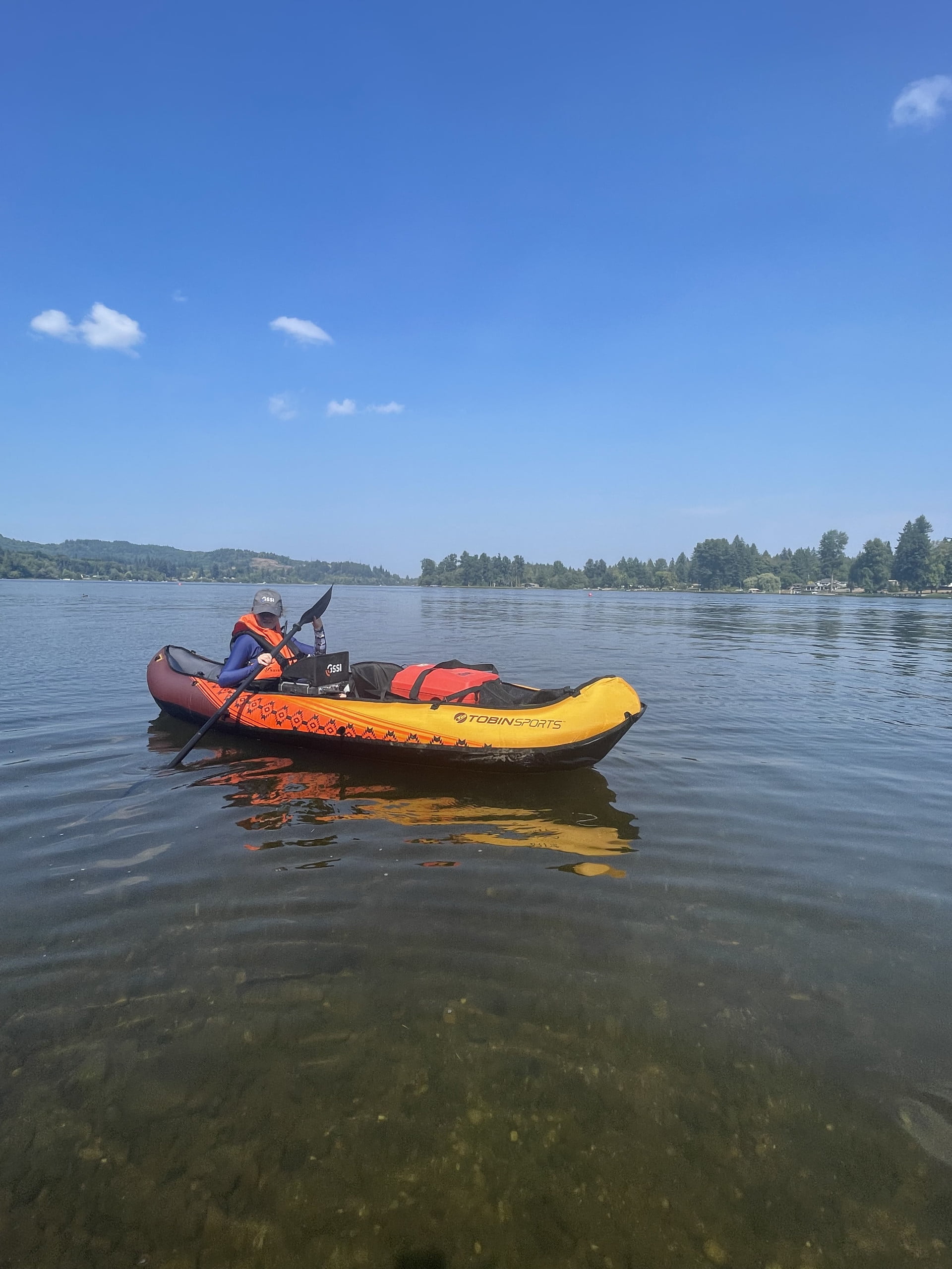
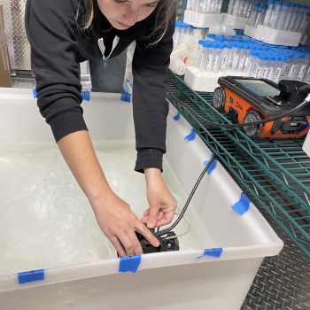
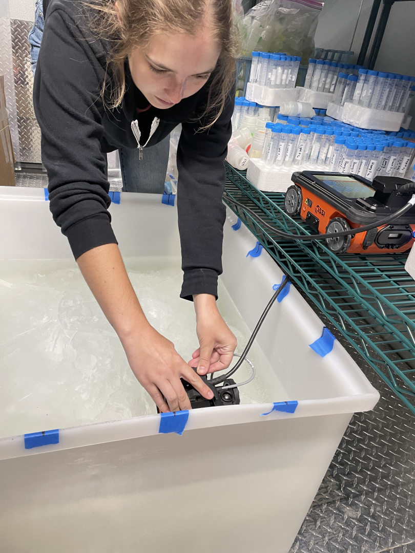
Underwater Geophysical Survey for Cultural Resources
Lindsey Holdener
No Category
575
16
Underwater Geophysical Survey for Cultural Resources
Lindsey Holdener
No Category
575
16
Underwater Geophysical Survey for Cultural Resources
Author: Lindsey Holdener
Votes: 16
900 MHz Near-Surface Glacier Survey on Eclipse Icefield
Mikaila Mannello
No Category
258
4
900 MHz Near-Surface Glacier Survey on Eclipse Icefield
Mikaila Mannello
No Category
258
4
900 MHz Near-Surface Glacier Survey on Eclipse Icefield
Author: Mikaila Mannello
Votes: 4
BIW
Scott Gove
No Category
260
5
BIW
Scott Gove
No Category
260
5
BIW
Author: Scott Gove
Votes: 5
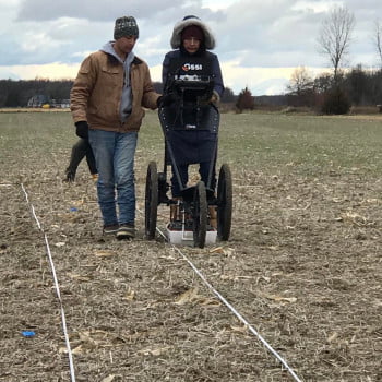
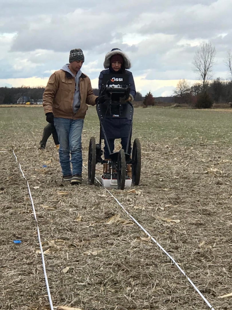
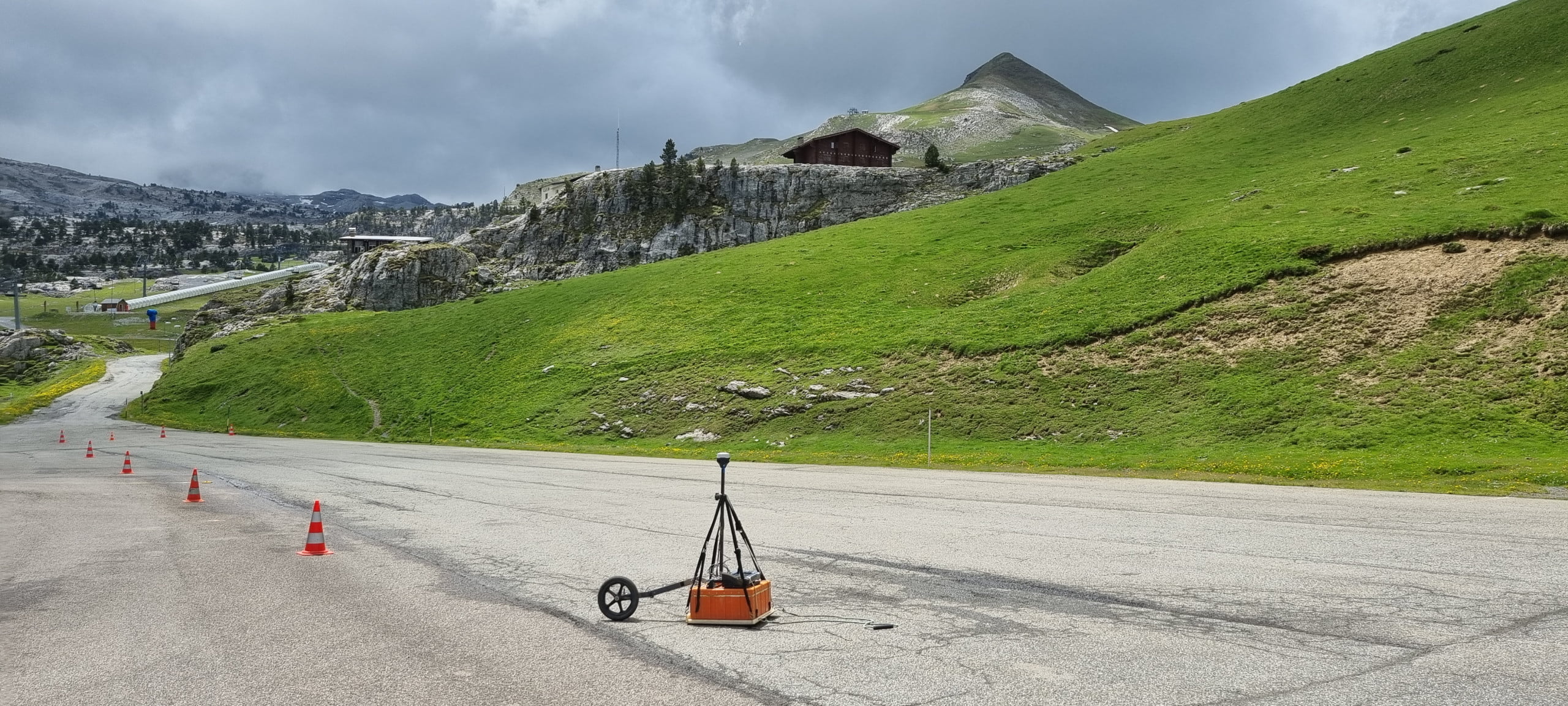
prep for winter, GSSI 200MHz
VERGERIO-ELISE
No Category
231
1
prep for winter, GSSI 200MHz
VERGERIO-ELISE
No Category
231
1
prep for winter, GSSI 200MHz
Author: VERGERIO-ELISE
Votes: 1
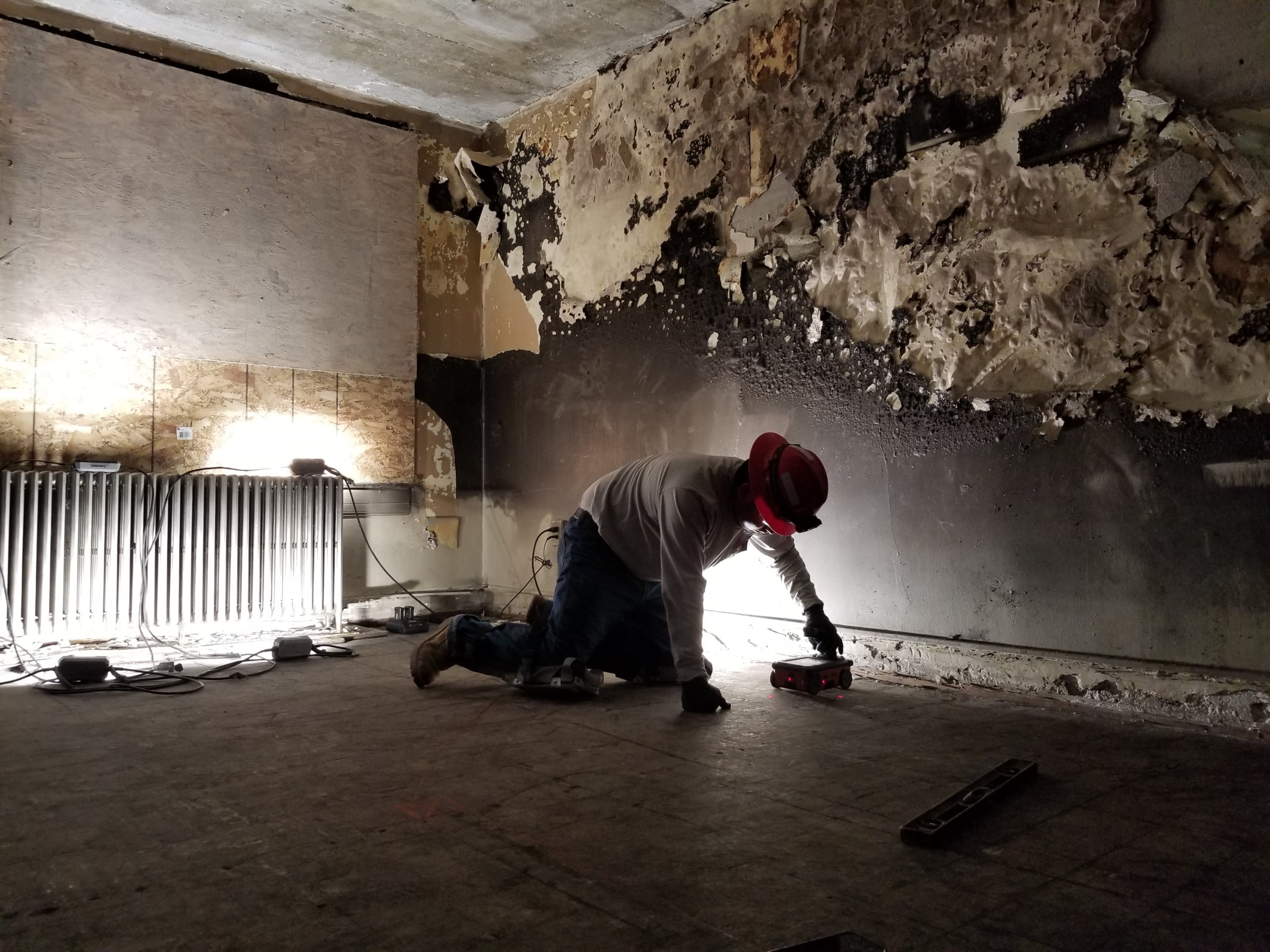
Black Magic
dplemel
No Category
247
15
Black Magic
dplemel
No Category
247
15
Black Magic
Author: dplemel
Votes: 15
Pulling Out All the Stops
dplemel
No Category
256
16
Pulling Out All the Stops
dplemel
No Category
256
16
Pulling Out All the Stops
Author: dplemel
Votes: 16
StructureScan in a crawl space
dplemel
No Category
251
17
StructureScan in a crawl space
dplemel
No Category
251
17
StructureScan in a crawl space
Author: dplemel
Votes: 17
Archaeological Prospecting in the Shadow of Maryland's 18th-Century Statehouse
Matthew McKnight
No Category
197
1
Archaeological Prospecting in the Shadow of Maryland's 18th-Century Statehouse
Matthew McKnight
No Category
197
1
Archaeological Prospecting in the Shadow of Maryland's 18th-Century Statehouse
Author: Matthew McKnight
Votes: 1
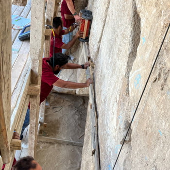
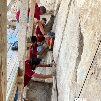
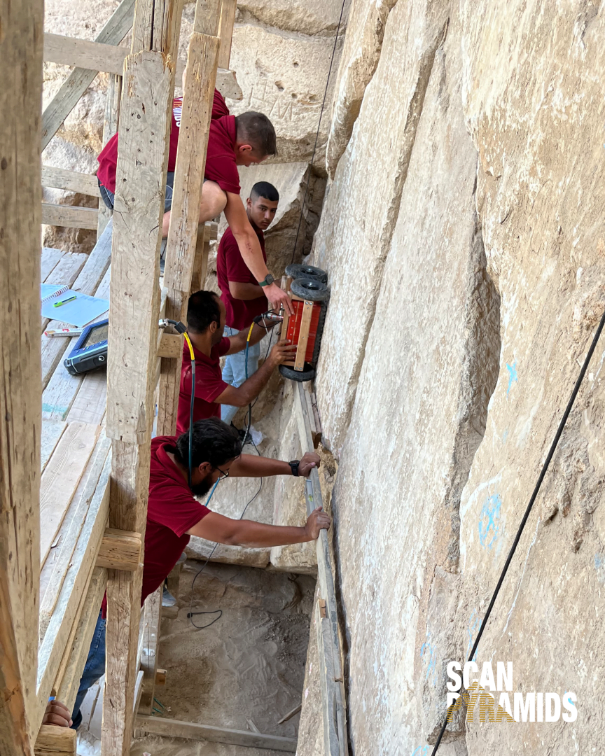
The Great Pyramid
Andreas Kathage
No Category
202
0
The Great Pyramid
Andreas Kathage
No Category
202
0
The Great Pyramid
Author: Andreas Kathage
Votes: 0
At the Great Pyramid
Andreas Kathage
No Category
193
1
At the Great Pyramid
Andreas Kathage
No Category
193
1
At the Great Pyramid
Author: Andreas Kathage
Votes: 1
Edsel and Eleanor Ford House
Aaron Camburn
No Category
219
1
Edsel and Eleanor Ford House
Aaron Camburn
No Category
219
1
Edsel and Eleanor Ford House
Author: Aaron Camburn
Votes: 1
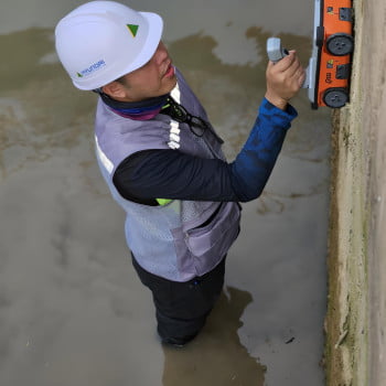
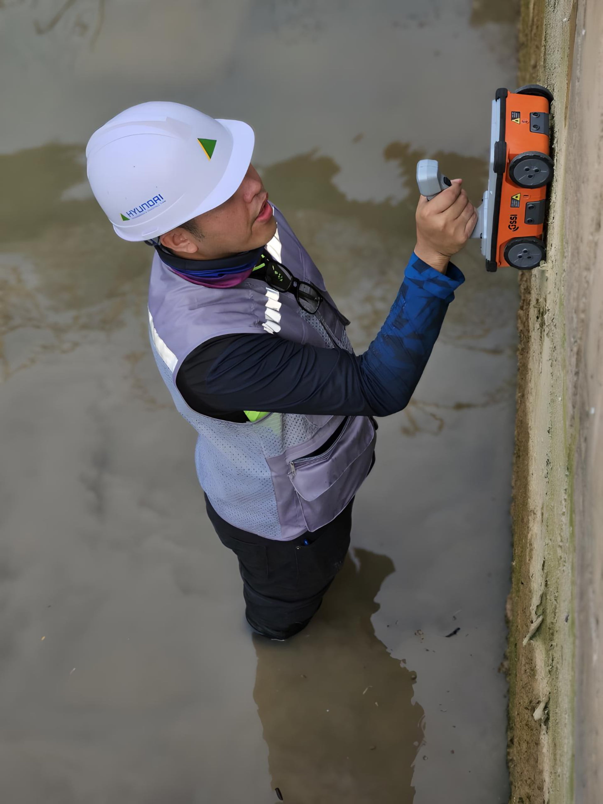
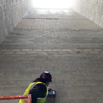
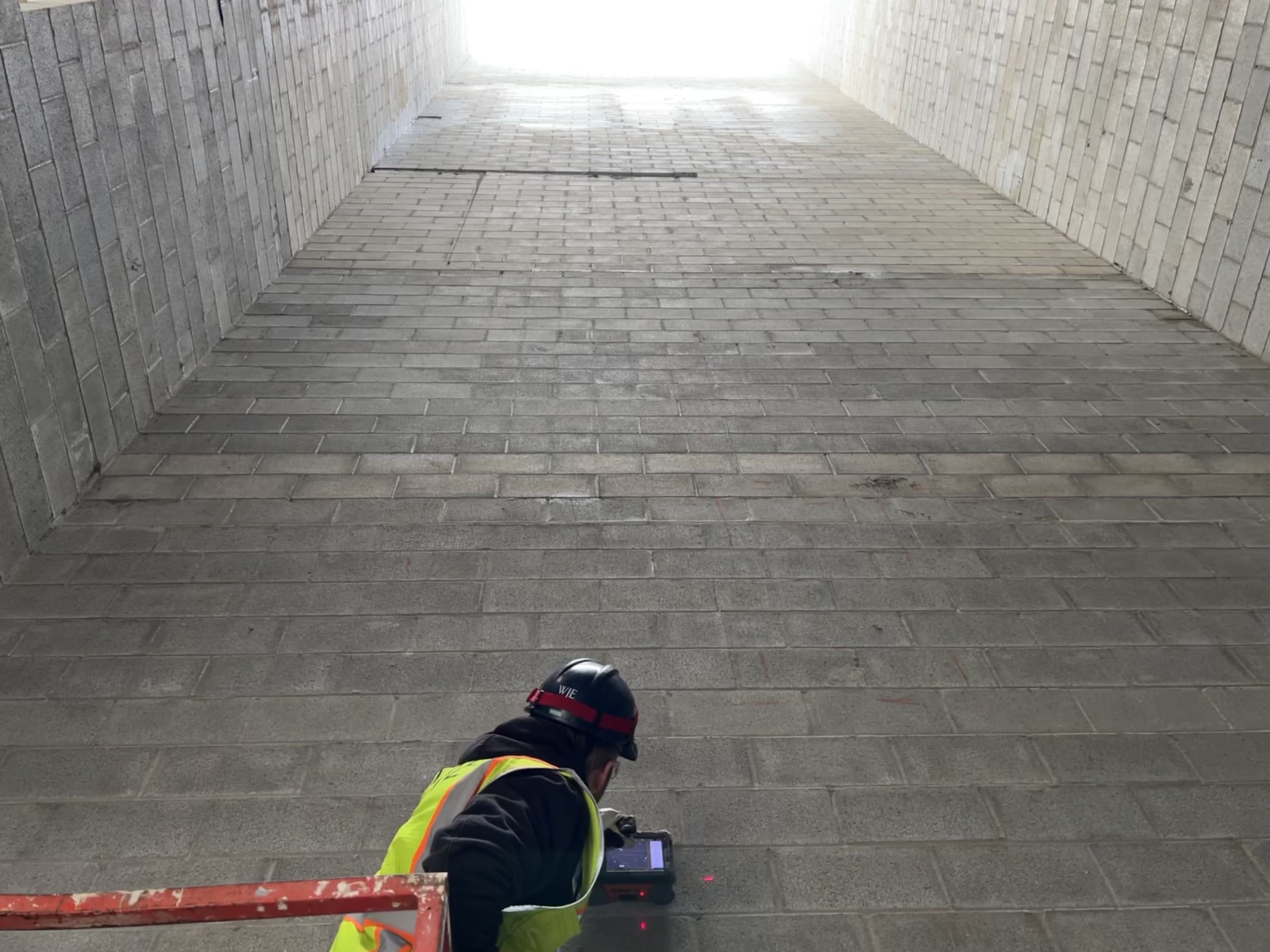
Exploring the Depths: GPR Scanning of Submerged Concrete in Canal's Rising Waters"
NITHISH VATTATHOOR
No Category
213
1
Exploring the Depths: GPR Scanning of Submerged Concrete in Canal's Rising Waters"
NITHISH VATTATHOOR
No Category
213
1
Exploring the Depths: GPR Scanning of Submerged Concrete in Canal's Rising Waters"
Author: NITHISH VATTATHOOR
Votes: 1
When scanning gets tough
Alex Tarussov
No Category
205
1
When scanning gets tough
Alex Tarussov
No Category
205
1
When scanning gets tough
Author: Alex Tarussov
Votes: 1
Lab experiments of ice on Mars
Ali Bramson
No Category
290
3
Lab experiments of ice on Mars
Ali Bramson
No Category
290
3
Lab experiments of ice on Mars
Author: Ali Bramson
Votes: 3
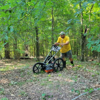
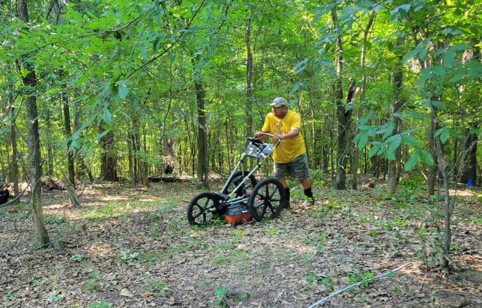
Finding all of the things
Hai Thanh
No Category
213
0
Finding all of the things
Hai Thanh
No Category
213
0
Finding all of the things
Author: Hai Thanh
Votes: 0
GSSI StructureScan Pro 1600Mhz antenna & 3000Sir Monitor Unit
Brendon
No Category
311
9
GSSI StructureScan Pro 1600Mhz antenna & 3000Sir Monitor Unit
Brendon
No Category
311
9
GSSI StructureScan Pro 1600Mhz antenna & 3000Sir Monitor Unit
Author: Brendon
Votes: 9
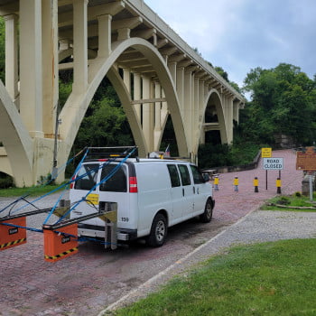
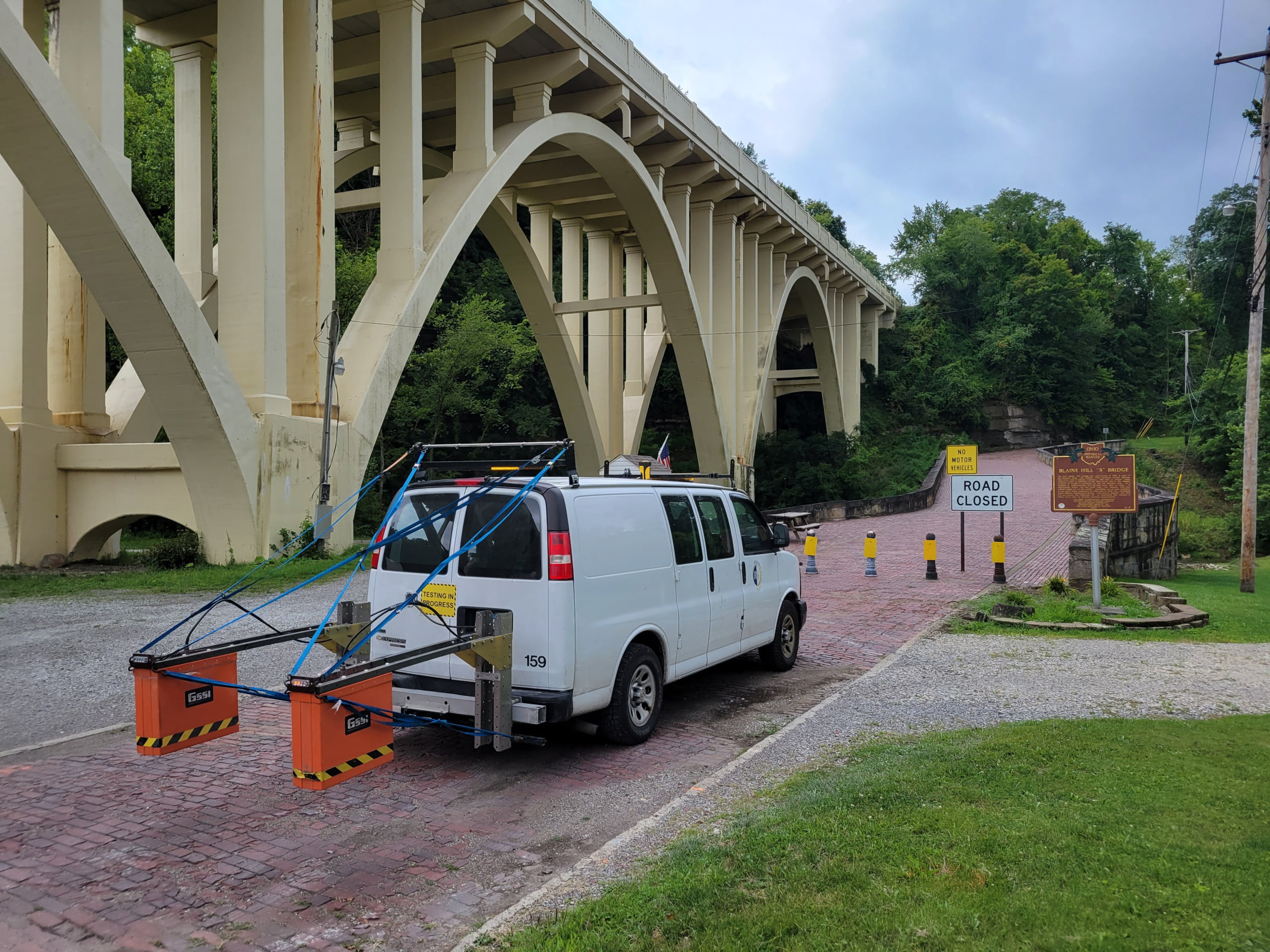
GPR Bridge Deck Survey on Historic Arch Bridge
DaFish777
No Category
232
1
GPR Bridge Deck Survey on Historic Arch Bridge
DaFish777
No Category
232
1
GPR Bridge Deck Survey on Historic Arch Bridge
Author: DaFish777
Votes: 1
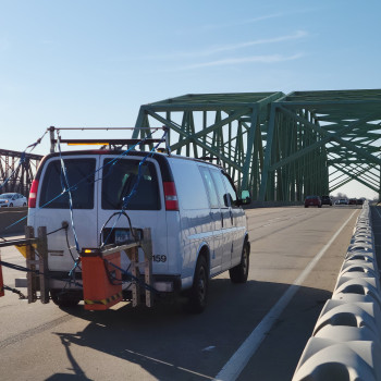
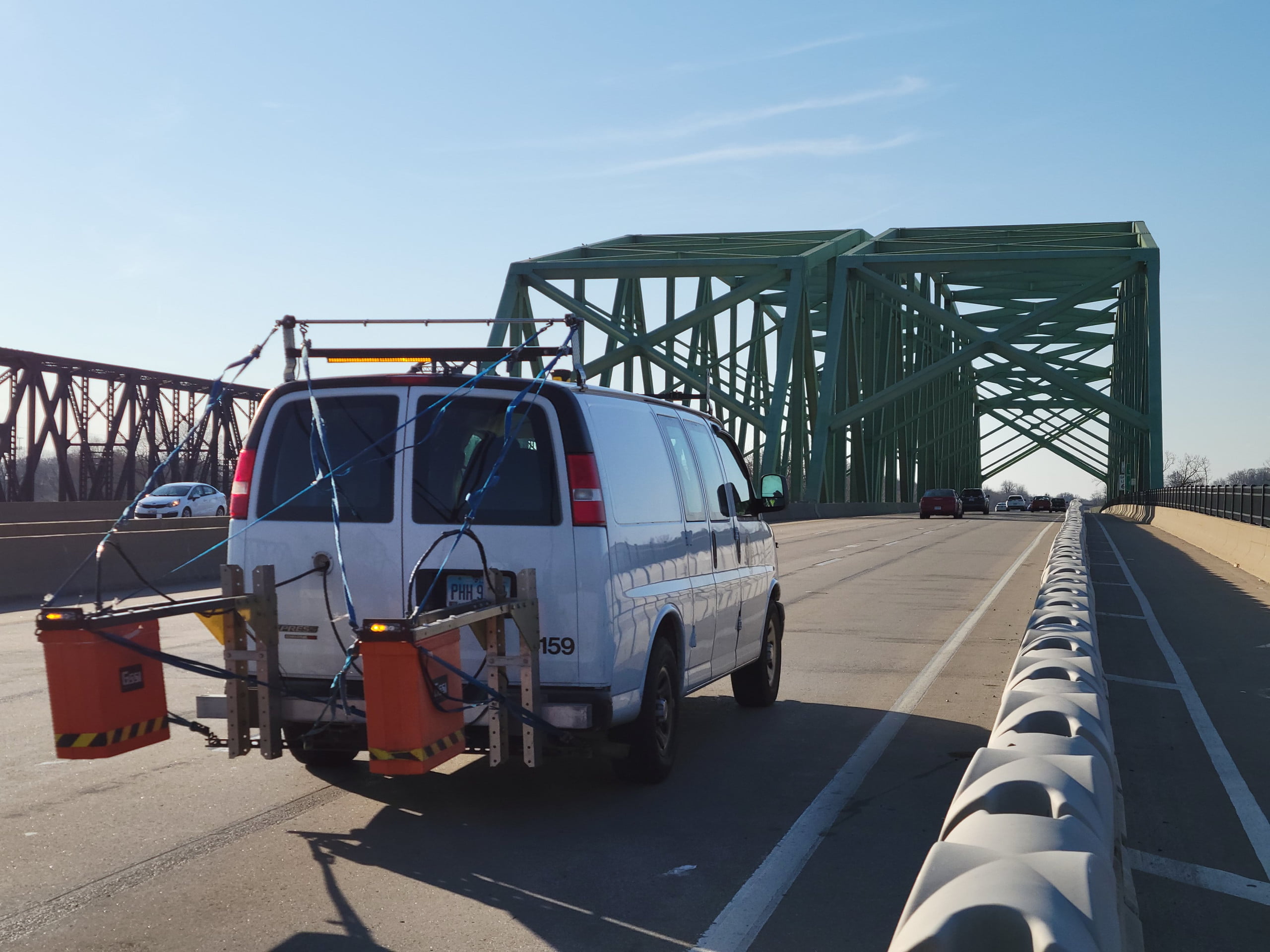
GPR & FWD Pavement Testing
DaFish777
No Category
224
1
GPR & FWD Pavement Testing
DaFish777
No Category
224
1
GPR & FWD Pavement Testing
Author: DaFish777
Votes: 1
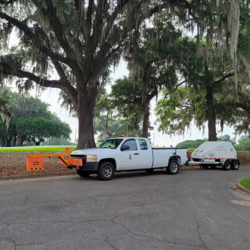
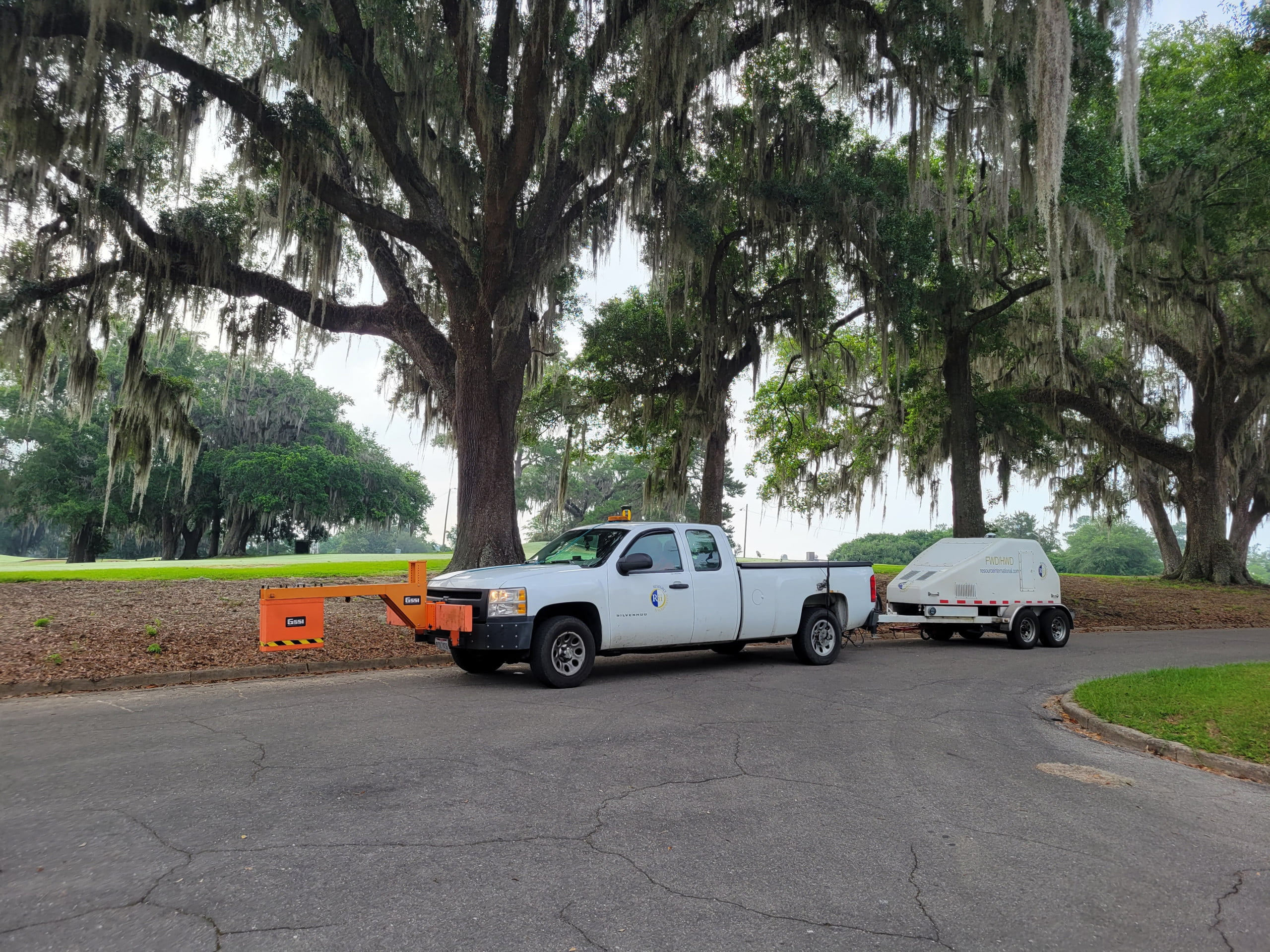
Missouri River Bridge
DaFish777
No Category
215
1
Missouri River Bridge
DaFish777
No Category
215
1
Missouri River Bridge
Author: DaFish777
Votes: 1
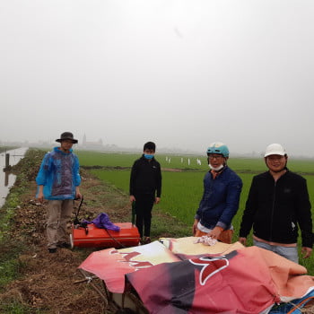
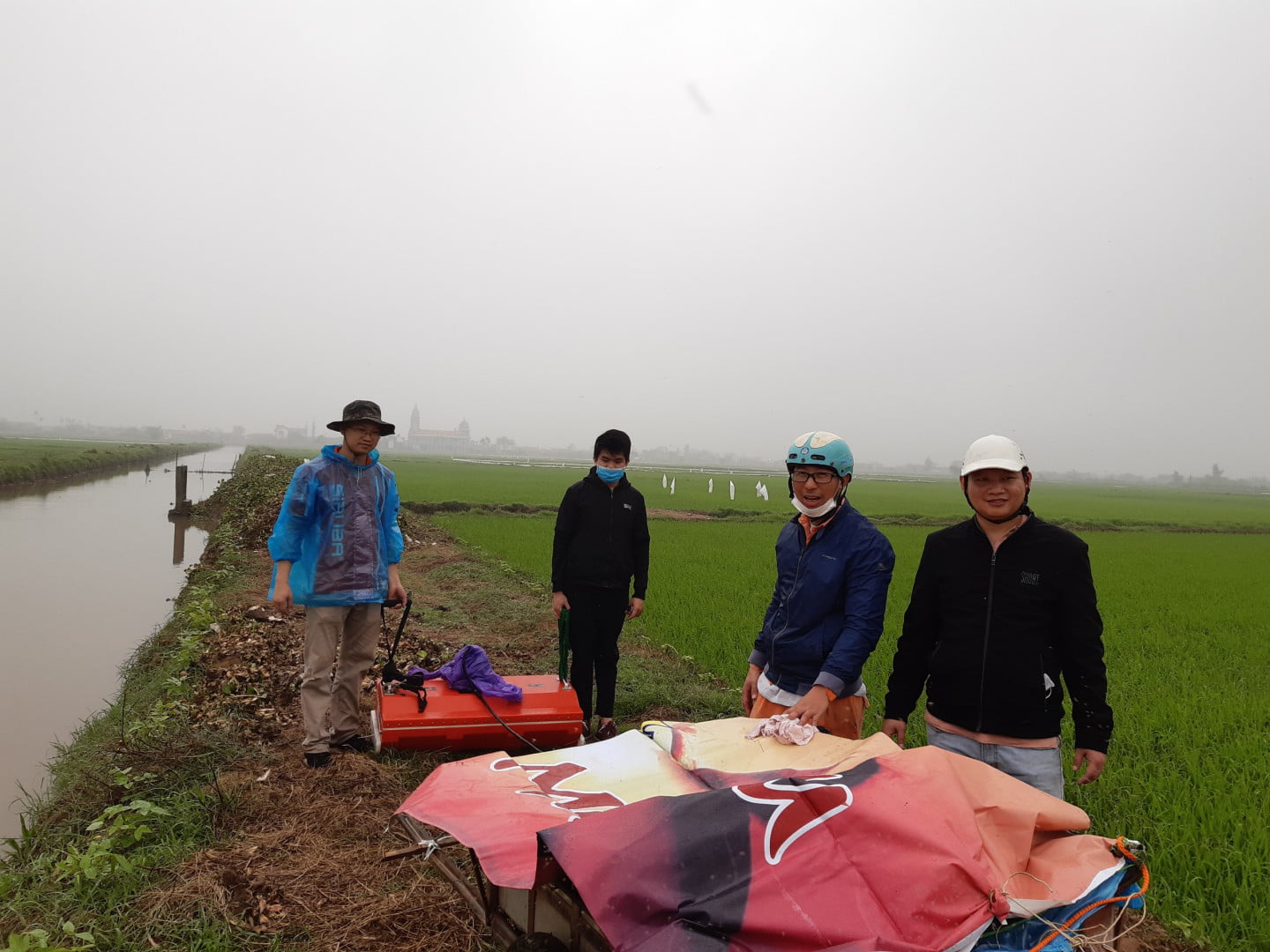
Utilities Survey Mapping
Rim
No Category
1634
443
Utilities Survey Mapping
Rim
No Category
1634
443
Utilities Survey Mapping
Author: Rim
Votes: 443
Archaeological survey of a Late Archaic (5800-3200 cal B.P.) shell ring site
Rachel Cajigas
No Category
356
21
Archaeological survey of a Late Archaic (5800-3200 cal B.P.) shell ring site
Rachel Cajigas
No Category
356
21
Archaeological survey of a Late Archaic (5800-3200 cal B.P.) shell ring site
Author: Rachel Cajigas
Votes: 21
Locating the Freedman's Cemetery on St. Catherines Island, GA, USA
Rachel Cajigas
No Category
327
24
Locating the Freedman's Cemetery on St. Catherines Island, GA, USA
Rachel Cajigas
No Category
327
24
Locating the Freedman's Cemetery on St. Catherines Island, GA, USA
Author: Rachel Cajigas
Votes: 24
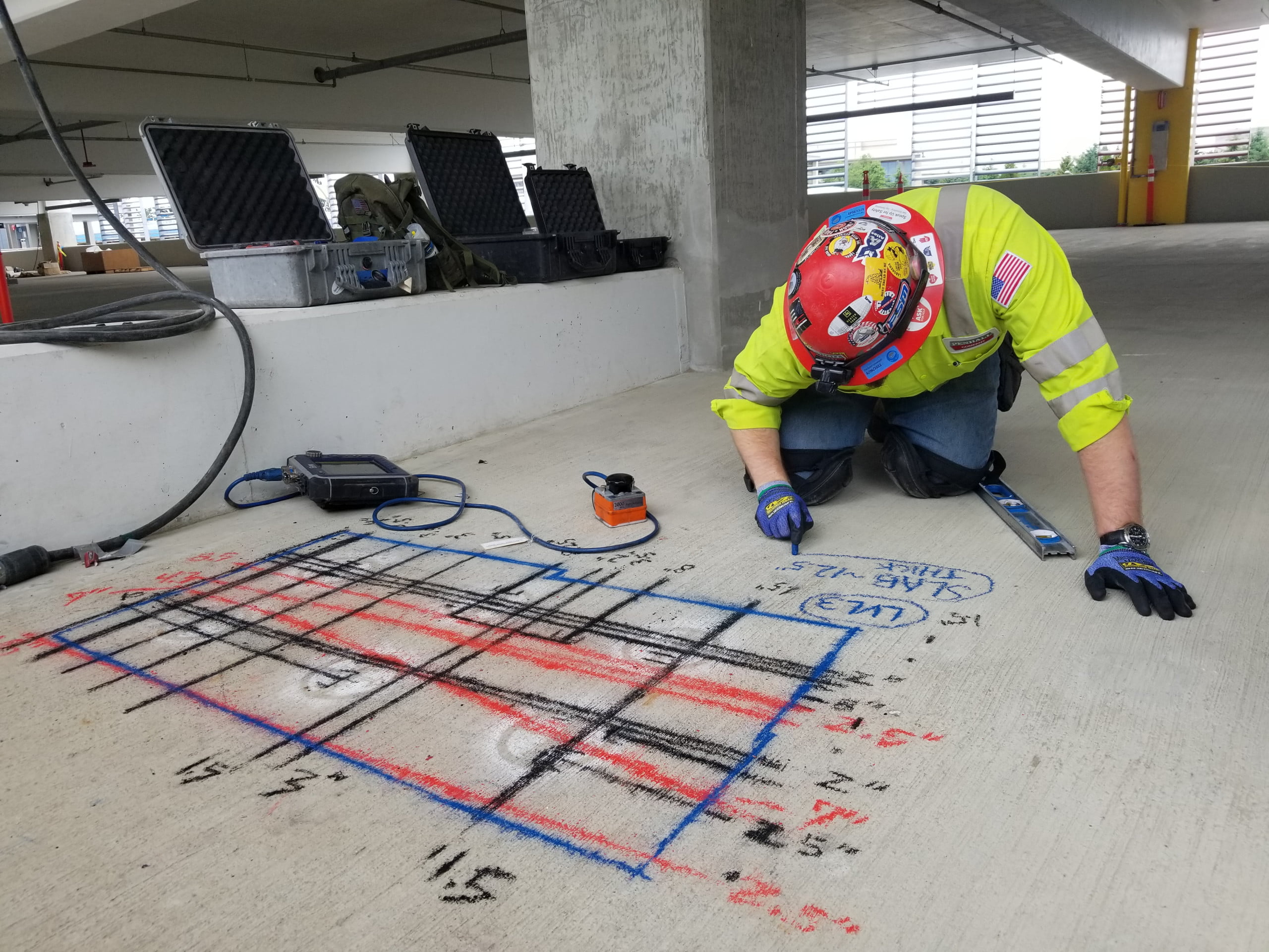
High control, high quality floors.
Pedro Teixeira dos Santos
No Category
1527
367
High control, high quality floors.
Pedro Teixeira dos Santos
No Category
1527
367
High control, high quality floors.
Author: Pedro Teixeira dos Santos
Votes: 367
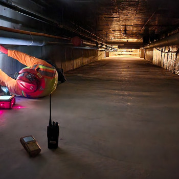
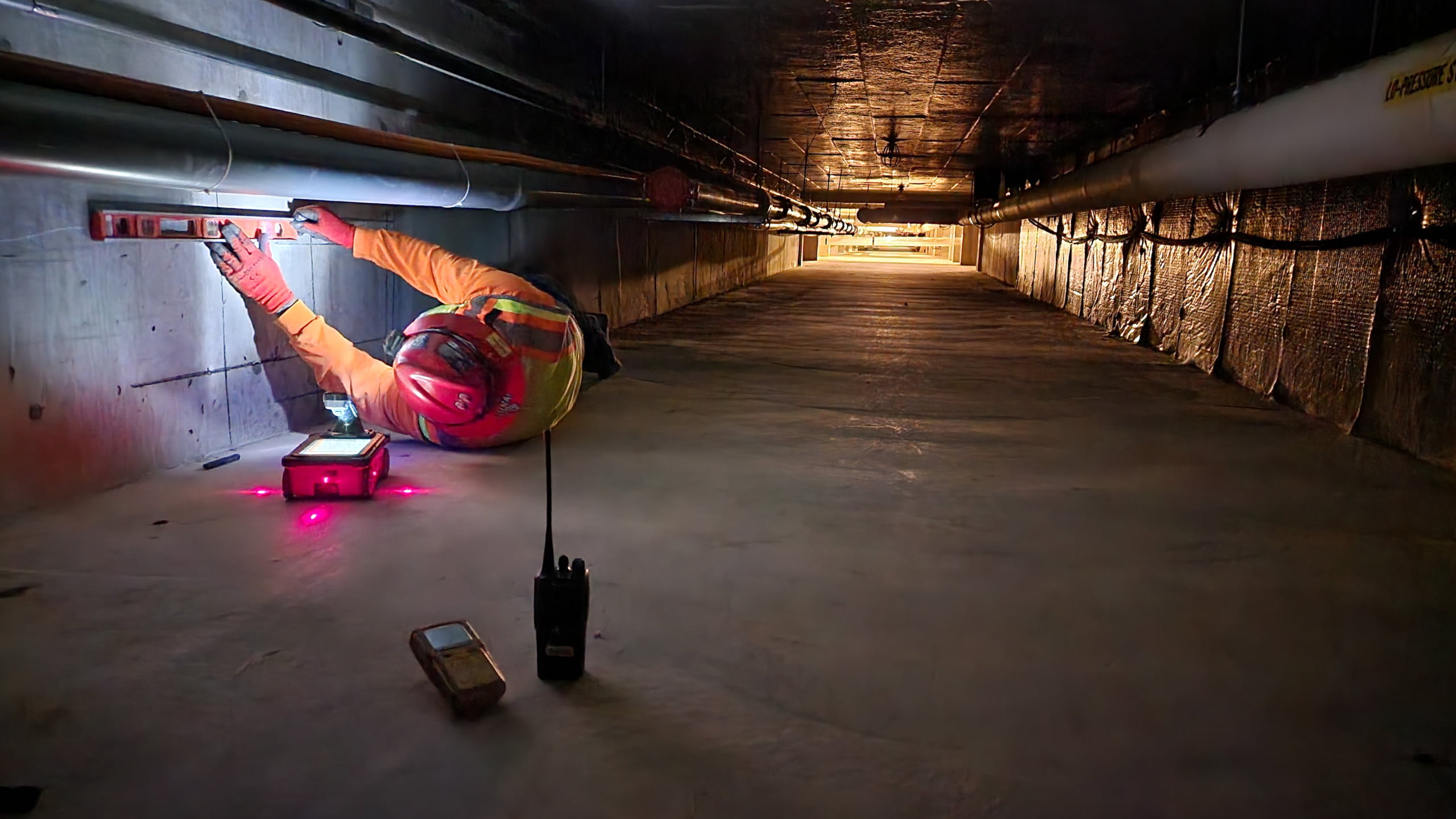
This one is almost a day off
BRUNO
No Category
287
1
This one is almost a day off
BRUNO
No Category
287
1
This one is almost a day off
Author: BRUNO
Votes: 1
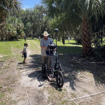
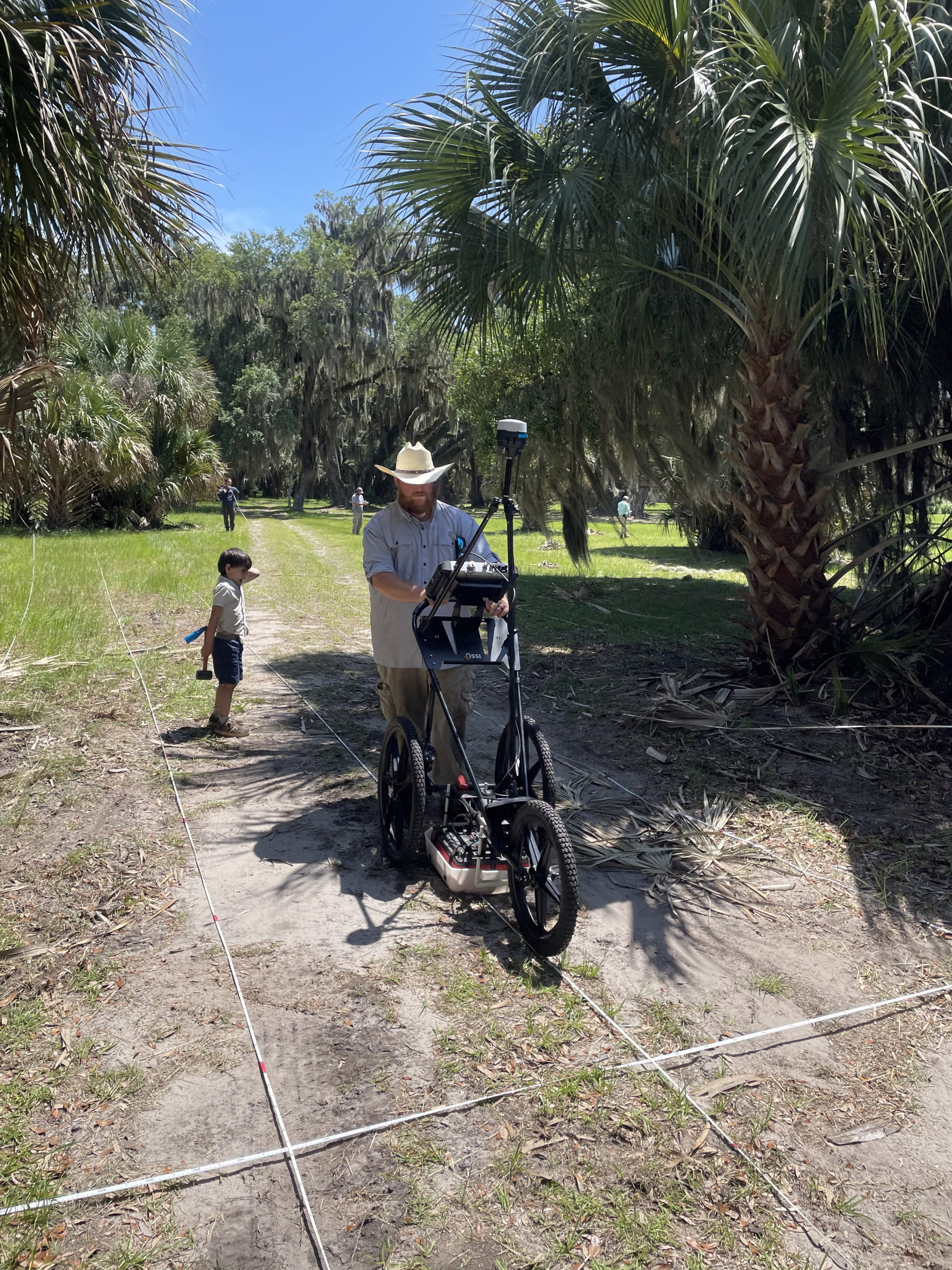
Non-Invasive GPR on our own Ancestral Homelands of The Muscogee Nation
gperez
No Category
252
4
Non-Invasive GPR on our own Ancestral Homelands of The Muscogee Nation
gperez
No Category
252
4
Non-Invasive GPR on our own Ancestral Homelands of The Muscogee Nation
Author: gperez
Votes: 4
17th Century Brewhouse Survey
rtchartrand1
No Category
538
19
17th Century Brewhouse Survey
rtchartrand1
No Category
538
19
17th Century Brewhouse Survey
Author: rtchartrand1
Votes: 19
17th Century Brewhouse Survey
rtchartrand1
No Category
285
2
17th Century Brewhouse Survey
rtchartrand1
No Category
285
2
17th Century Brewhouse Survey
Author: rtchartrand1
Votes: 2
Determining the geological structure of the shallow
kha
No Category
224
2
Determining the geological structure of the shallow
kha
No Category
224
2
Determining the geological structure of the shallow
Author: kha
Votes: 2
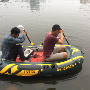
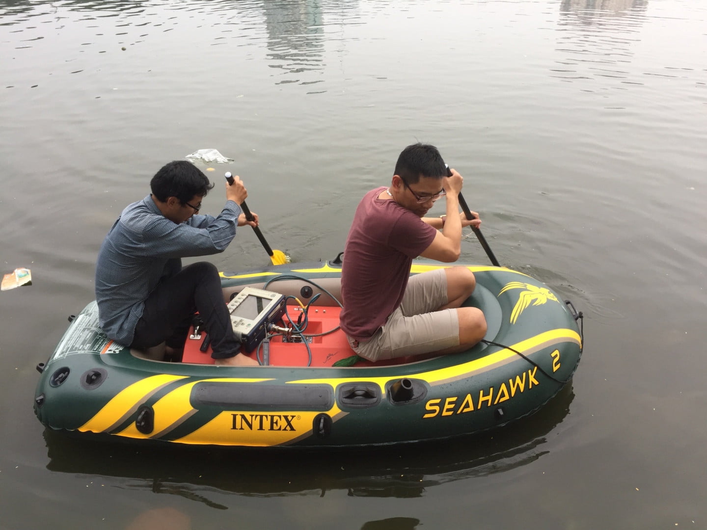
Determine the thickness of the mud sediment of Linh Dam Lake
kha
No Category
239
2
Determine the thickness of the mud sediment of Linh Dam Lake
kha
No Category
239
2
Determine the thickness of the mud sediment of Linh Dam Lake
Author: kha
Votes: 2
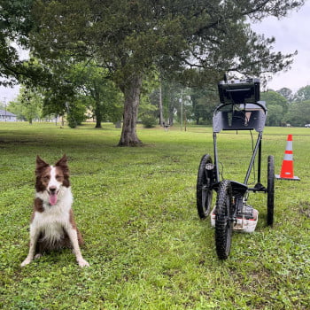
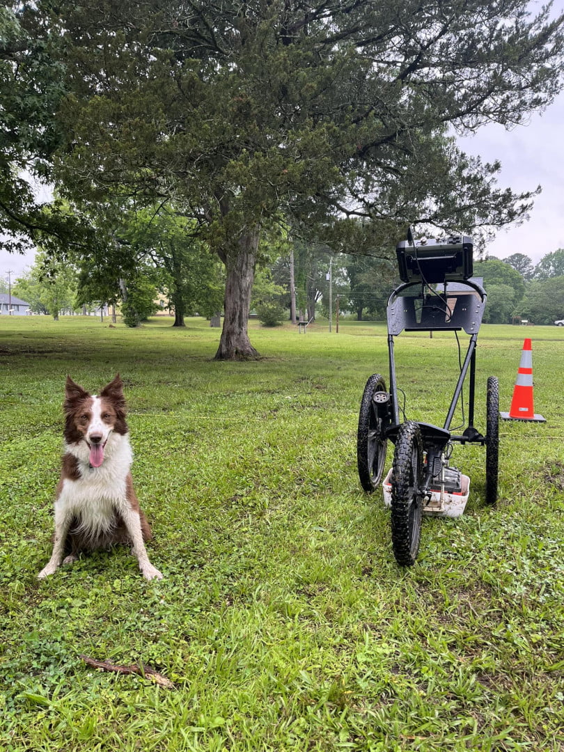
Four legged surveyor
Jordan Cole
No Category
213
2
Four legged surveyor
Jordan Cole
No Category
213
2
Four legged surveyor
Author: Jordan Cole
Votes: 2
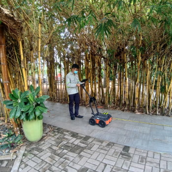
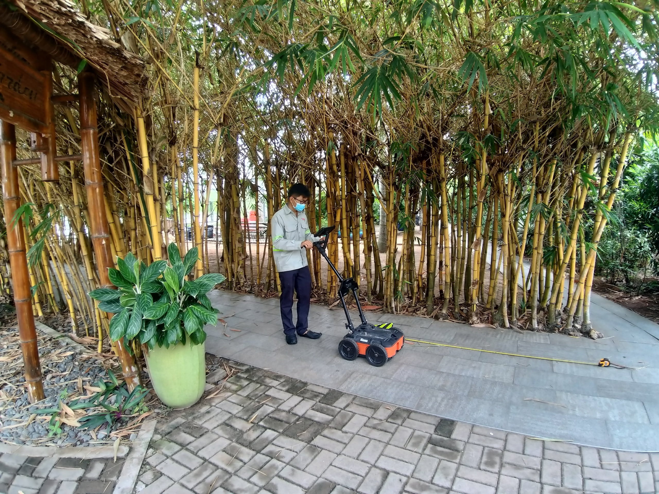
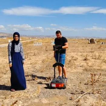
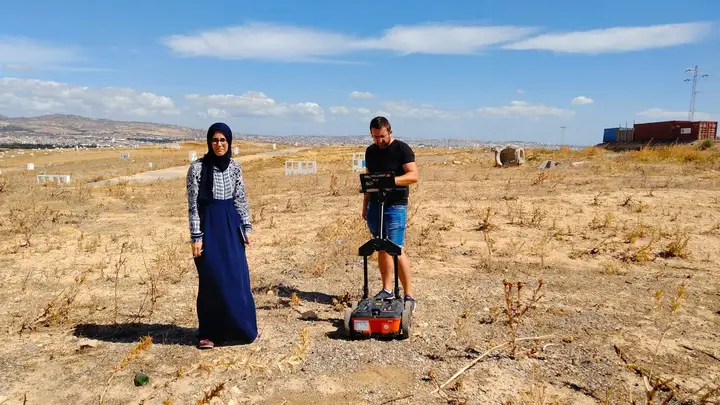
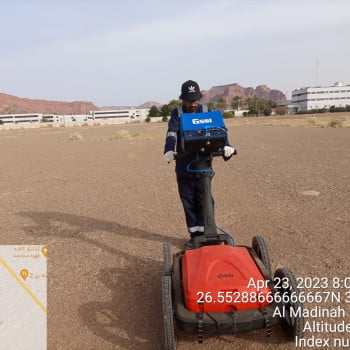
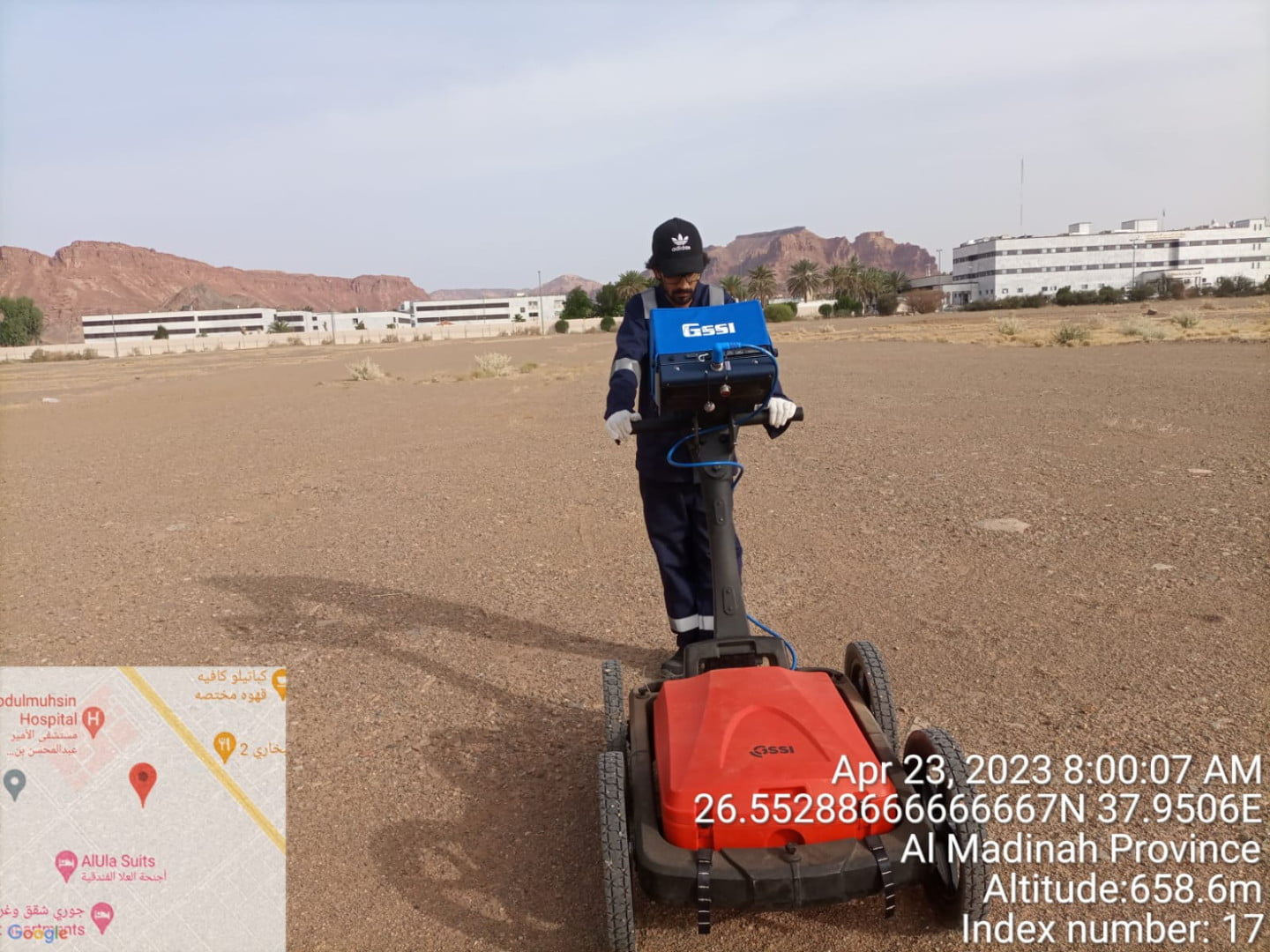
UTILITY MAPPING
Mohamed Niyas
No Category
277
27
UTILITY MAPPING
Mohamed Niyas
No Category
277
27
UTILITY MAPPING
Author: Mohamed Niyas
Votes: 27
Unveiling the Hidden Veins Within the Concrete: GPR's Quest at Bishan Depot
NITHISH VATTATHOOR
No Category
238
1
Unveiling the Hidden Veins Within the Concrete: GPR's Quest at Bishan Depot
NITHISH VATTATHOOR
No Category
238
1
Unveiling the Hidden Veins Within the Concrete: GPR's Quest at Bishan Depot
Author: NITHISH VATTATHOOR
Votes: 1
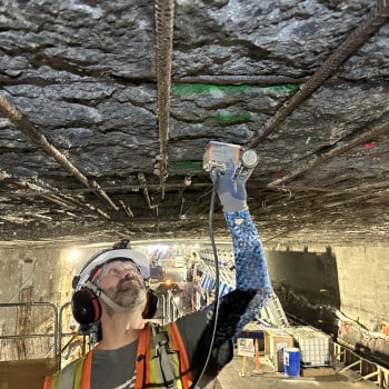
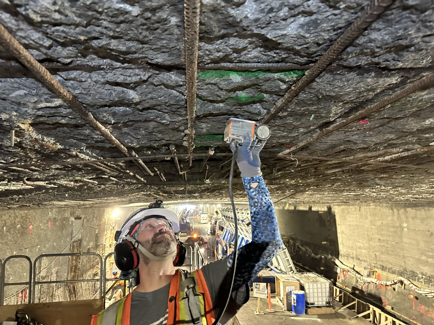
Looking skyward
Dan Wetherington
No Category
230
0
Looking skyward
Dan Wetherington
No Category
230
0
Looking skyward
Author: Dan Wetherington
Votes: 0
Hamad Khan
Hamad Khan
No Category
421
22
Hamad Khan
Hamad Khan
No Category
421
22
Hamad Khan
Author: Hamad Khan
Votes: 22
1
2