Products
Flex NX
Flex NX
StructureScan
StructureScan Pro
StructureScan Mini XT
StructureScan Mini LT
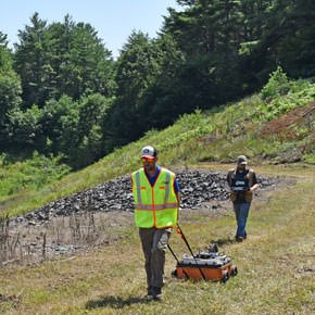
UtilityScan
GSSI’s Utility Scan Pro GPR
UtilityScan
UtilityScan DF
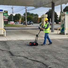
PaveScan RDM 2.0
RoadScan
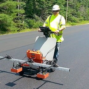
BridgeScan
GS Series
200 HS Antenna
SIR Systems
SIR 4000
SIR 30
LifeLocator TRx
Antennas
RADAN Software
Accessories
View All
Solutions
Concrete Inspection
Utility Locating & Mapping
Transportation
Environmental
Geology & Geophysics
Archaeology & Forensics
Search & Rescue
View All
Innovation Lab
Our Approach
Our Process
Our Lab
GSSI Academy
Training Schedule
Why Train at GSSI
Upcoming Events
Technology Explained
What Is GPR?
What is EM?
What is UWB?
Resources
Meet the Trainers
Contact Training
Support
Call Support
Helpful Resources
Email Support
Download Resources
FAQ’s
Regulatory Information
Contact
Where We’re Located
Call GSSI
Local Accomodations
Rental Companies
Email GSSI
Upcoming Shows and Conferences
Finance Information
About GSSI
Careers
GSSI News
Products
Flex NX
Flex NX
Flex NX®, powered by Nexus™ is the industry’s most powerful and complete concrete scanning system. Use Flex NX™ on its own, or pair an NX wireless satellite antenna to be ready for any jobsite challenge.
Structurescan
StructureScan Pro
Structurescan Pro
The StructureScan Pro is a versatile concrete inspection system based on the SIR 4000, and offers a wide variety of antenna options for concrete applications.
StructureScan Mini XT
Structurescan Mini XT
The StructureScan™ Mini XT is the tool designed for today’s professional concrete scanner and built to handle all your job site and survey needs.
StructureScan Mini LXT
StructureScan Mini LXT
The StructureScan™ Mini LXT is designed and built for the concrete contractor who needs to locate and mark targets in concrete.
UtilityScan
UtilityScan Pro
UtilityScan Pro
The UtilityScan Pro is a versatile utility locating system based on the SIR 4000, and offers several options for customization.
UtilityScan
UtilityScan
UtilityScan is an indispensable tool for utility locating professionals around the world to easily and accurately map utilities in real-time.
UtilityScan DF
UtilityScan DF
The UtilityScan DF incorporates our innovative dual-frequency digital antenna (300/800 MHz) and a touchscreen interface to view shallow and deep targets simultaneously in a single scan.
PaveScan
PaveScan RDM 2.0
PaveScan RDM 2.0
The PaveScan RDM uses the dielectric measurements of new pavement to determine pavement quality and uniformity.
PaveScan MDM
PaveScan MDM
PaveScan Mix Design Module (MDM) is a powerful new tool for QA/QC labs.
RoadScan
RoadScan
The RoadScan™ 30 system is based on the SIR 30 and provides users with an effective tool for quickly determining pavement layers at high speeds.
BridgeScan
BridgeScan
The BridgeScan™ is a complete, affordable GPR system that is an effective tool for quickly determining the condition of aging bridge decks.
GS Series
200 HS Antenna
The 200 HS digital, wireless antenna is ideal for geophysical, geotechnical, and environmental applications that require high reliability under challenging survey conditions.
SIR Systems
SIR 4000
SIR 4000
The SIR® 4000 is GSSI’s first high-performance GPR data acquisition system designed to operate with analog and digital antennas.
SIR 30
SIR 30
The SIR® 30 is the next-generation multi-channel GPR control unit. This system can collect up to eight channels of data simultaneously with uncompromised performance.
Antennas
Software
Accessories
View All
Not sure which product is right for you?
Let us help you decide »
Solutions
Concrete Inspection
Concrete Inspection
Cutting and coring experts and construction professionals require a reliable, non-destructive solution to assess concrete and concrete structures.
Utility locating
Utility locating
Utility locators, construction professionals, environmental firms and land surveyors need to know about underground assets prior to digging and trenching efforts.
Transportation
Transportation
Highway professionals, engineers and transportation departments require a safe, reliable and non-destructive method to evaluate roads and bridges.
Environmental
Environmental
The key to a comprehensive environmental assessment is the subsurface investigation.
Geology & Geophysics
Geology & Geophysics
Ground penetrating radar (GPR) offers an accurate, non-destructive solution to mapping the subsurface of the earth.
Archaeology & Forensics
Archaeology & Forensics
Archaeologists and remote sensing specialists around the world rely on GSSI ground penetrating radar as a key tool for non-invasive site investigation.
View All
Innovation Lab
Our Approach
Our Process
Our Lab
GSSI Academy
Training Schedule
Why Train at GSSI
Upcoming Events
Technology Explained
What Is GPR?
What is EM?
What is UWB?
Resources
Meet the Trainers
Contact Training
Support
Call Support
Helpful Resources
Email Support
Download Resources
FAQ’s
Regulatory Information
Patents
Contact
Where We’re Located
Call GSSI
Local Accommodations
Rental Companies
Email GSSI
Upcoming Shows
Finance Information
Contact Us
Updates From Around GSSI
View All News
View All Trade Shows
Articles
Blog
GSSI News
Press Release
Blog
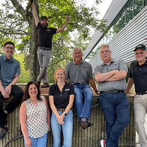
Meet the GSSI Operations Team
Blog
2023 Photo Contest Winners
Blog
Come See the New Flex NX™ at Our Fall Showcases
GSSI News
Orange Box Blog #1: An Overview of Normal and Cross-Polarized GPR Antennas for Concrete Scanning
Blog
Rep Spotlight: Red Dog Scientific Services
Blog
Rep Spotlight: Codevintec Italiana
Blog
2022 Photo Contest Winners
Blog
GSSI Named The Best Company to Work for in New Hampshire in 2022
Blog
Dam Inspections with Ground Penetrating Radar Technology
Blog
New GSSI Infographic
Blog
Advanced GPR Data Processing Workshop
Blog
Concrete Inspection: The Advantages of Using Ground Penetrating Radar (GPR)
GSSI News
Join Us for Our Free GSSI Showcase in Texas
Blog
GPR Equipment Key Tool for Scientists Measuring Health of Antarctica’s Doomsday Glacier
Blog
Business New Hampshire Magazine 2021 Best Companies to Work For
Blog
Announcing the Winners!
Blog
The GSSI Technical Support Team is Growing
Blog
GSSI Equipment at the Top of Mount Everest
Blog
Tips from the Trainer: Integrating GPS with GPR
Blog
GSSI is a Founding Member of Dam Safety Group
Blog
Paving Season is Right Around the Corner
Trade Shows
WORLD OF CONCRETE 2021
Blog
Using GPR Technology for Underground Utility Locating Reduces Risks of Injury and Costly Damages
Blog
GSSI Academy: How to Bring Out GPR Targets More Clearly Using Gain
Blog
GSSI’s Innovations Throughout the Years – 2000-2009
GSSI News
GSSI Named The Best Company to Work for in New Hampshire in 2020
Blog
GPR for Utility Locating Offers Safety, Efficiency, and Revenue Benefits
Blog
Employee Spotlight Series: Kevin Reardon
GSSI News
2020 Photo Contest Winners Announced!
Blog
2D Cemetery Mapping Using GPR
GSSI News
Software Update to StructureScan™ Mini XT GPR System and New Palm XT Antenna Accessory
Press Release
GSSI Announces Distribution Agreement with InstroTek on PaveScan® RDM
Blog
Three Keys to Success: Cemetery Mapping
GSSI News
It’s Time for the 2020 GSSI Calendar Photo Contest!
Blog
GSSI Academy: Getting Started with RADAN 7
Blog
GSSI’s Innovations Through the Years – 1990-1999
Blog
GSSI Academy: Using GPR to Identify Types of Utilities
Blog
Behind the Scenes with GSSI: Customer Edition – Most Memorable Surveys
Blog
GSSI Academy: Understanding the Dielectric Constant
GSSI News
GSSI Academy Announces Upcoming Training Schedule
Blog
On the Road: Geophysical Survey using GPR
Blog
Behind the Scenes with GSSI: Our Most Memorable Surveys
GSSI News
Update Regarding GSSI’s Response to COVID-19
GSSI News
GSSI Announces Marc Lussier as New VP of Operations
Blog
GSSI’s Innovations Through the Years – 1970-1989
Blog
Jamestown Uses GPR to Define Lost 17th Century Landscape
Blog
GSSI Commemorates 50 Years of Excellence
Blog
On Location with the GSSI Academy: McMurdo Station, Antarctica
Blog
The Challenge with Slab-on-Grade; Get the Most Out of Your GPR Data
GSSI News
GSSI Announces the GS Series GPR Product Line for Geophysical and Environmental Surveys
Blog
Non-Destructive GPR Technology Saves Time and Money on Transportation Infrastructure Repairs
Blog
GSSI Recognized as One of the 2019 Best Companies to Work for in New Hampshire
GSSI News
2019 Photo Contest Winners Announced!
Press Release
Ground Penetrating Radar: The Unlikely New Hero of Autonomous Vehicles
GSSI News
GSSI Named The Best Company to Work for in New Hampshire
Blog
Alaska Leads the Way in Detecting Road Defects Before They Lead to Premature Failures
Trade Shows
Public Works Expo 2019
Press Release
Improved UtilityScan® Features with Software Update
Blog
Affordable, Compact and Durable New Tool for Professional Utility Location Contractors
Blog
Employee Spotlight Series: Andrea Abreu
Blog
Powerful New GPR Tool Helps Contractors Ensure Road Pavement Quality
Blog
Using GPR Scanning Prior To Concrete Cutting Saves Money and Avoids Hazardous Conditions
GSSI News
GSSI Announces New Distributor Partnership with Blinken Tools, Aligning to its Global Growth Strategy
GSSI News
GSSI Receives Presidential Award for Exports
Press Release
Improved StructureScan™ Mini XT GPR Concrete Inspection Features with Software Update
Trade Shows
World of Asphalt 2019 – Feb 12-14, 2019
Trade Shows
Canadian Concrete Expo 2019 – Feb. 6-7, 2019
Trade Shows
GSSI Showcases Its Latest GPR Technology at World of Concrete
Trade Shows
2019 Transportation Research Board Meeting
Trade Shows
See GSSI at The Buildings Show in Toronto
Trade Shows
GSSI Showcases Newest GPR Equipment at 2018 CCGA Damage Prevention Symposium
Trade Shows
GSSI Showcases Newest GPR Equipment at ASNT Annual Conference
GSSI News
2018 Photo Contest Winners Announced!
GSSI News
It’s Time for the 2018 GSSI Calendar Photo Contest!
Press Release
GSSI Announces New Technical Application Specialist
Trade Shows
GSSI Showcases and Demonstrates World Leading GPR Systems in Switzerland
Press Release
GSSI Announces Licensing Agreement with MIT Lincoln Laboratory
Press Release
Training School on Ground Penetrating Radar for Civil Engineering and Cultural Heritage Management
GSSI News
Announcing New US Sales Territories
Trade Shows
World of Asphalt (WOA)
Trade Shows
National Pavement Expo (NPE)
Trade Shows
Canadian Concrete Expo
Press Release
New Palm Antenna for StructureScan™ Mini XT
Articles
Using Ground-Penetrating Radar on Archaeological Sites
Trade Shows
World of Concrete 2018
Trade Shows
Transportation Research Board 97th Annual Meeting (TRB)